Approximate Location Map
Large Map »
Latitude: 53.2794 / 53°16'45"N
Longitude: -2.0768 / 2°4'36"W
OS Eastings: 394976
OS Northings: 375827
OS Grid: SJ949758
Mapcode National: GBR FZYJ.54
Mapcode Global: WHBBJ.2TBT
Plus Code: 9C5V7WHF+Q7
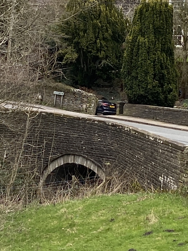
Entry Name: Rainow Bridge
Listing Date: 9 December 1983
Grade: II
Source: Historic England
Source ID: 1312565
English Heritage Legacy ID: 58071
ID on this website: 101312565
Location: Rainow, Cheshire East, Cheshire, SK10
County: Cheshire East
Civil Parish: Rainow
Traditional County: Cheshire
Lieutenancy Area (Ceremonial County): Cheshire
Church of England Parish: Rainow Holy Trinity
Church of England Diocese: Chester
Tagged with: Bridge
SJ 97 NW RAINOW C.P. TOWER HILL
2/160 Rainow Bridge
GV II
Bridge over River Dean: late C18. Buff sandstone rubble. Segmental
arch has a projecting rubble course above with a plain parapet and a
flat coping continuing as short wing walls.
Probably built by the Macclesfield to Whaley Bridge turnpike trust
c.1770 and similar to Reed and Kishfield Bridges, Kettleshulme (q.v.).
Listing NGR: SJ9497675827
External links are from the relevant listing authority and, where applicable, Wikidata. Wikidata IDs may be related buildings as well as this specific building. If you want to add or update a link, you will need to do so by editing the Wikidata entry.


Other nearby listed buildings
