Latitude: 54.5537 / 54°33'13"N
Longitude: -0.8819 / 0°52'54"W
OS Eastings: 472413
OS Northings: 518185
OS Grid: NZ724181
Mapcode National: GBR QH8S.WD
Mapcode Global: WHF89.FS8X
Plus Code: 9C6XH439+F6
Entry Name: 2-7, St Hilda's Place
Listing Date: 27 February 1987
Grade: II
Source: Historic England
Source ID: 1312644
English Heritage Legacy ID: 60218
ID on this website: 101312644
Location: Loftus, Redcar and Cleveland, North Yorkshire, TS13
County: Redcar and Cleveland
Civil Parish: Loftus
Built-Up Area: Loftus
Traditional County: Yorkshire
Lieutenancy Area (Ceremonial County): North Yorkshire
Church of England Parish: Loftus-in-Cleveland St Leonard
Church of England Diocese: York
Tagged with: Building
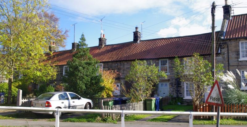
LOFTUS ST. HILDA'S PLACE, Loftus. NZ 71 NW 4/61 Nos. 2 to 7 consecutive. G.V. II Terrace of 6 cottages, Nos. 6 and 7 late C18, No. 5 c.1800, and Nos. 2 to 4 early C19. Dressed sandstone with chamfered plinth at Nos 6 and 7. Clay pantile roofs, renewed on Nos. 2 to 5. Stone ridge copings; gable copings and block kneelers at left end of No. 2. 2 storeys, 2 windows to No. 6, the rest one window each. Doorways at right-hand side of each. Nos. 2,3,4 and 7 have renewed 6-panel doors. Nos. 5 and 6 have half-glazed doors. Renewed sashes with glazing bars and stone sills. Five corniced stacks at ends and junctions.
Listing NGR: NZ7241318185
External links are from the relevant listing authority and, where applicable, Wikidata. Wikidata IDs may be related buildings as well as this specific building. If you want to add or update a link, you will need to do so by editing the Wikidata entry.


Other nearby listed buildings