Latitude: 51.6116 / 51°36'41"N
Longitude: -2.5293 / 2°31'45"W
OS Eastings: 363444
OS Northings: 190435
OS Grid: ST634904
Mapcode National: GBR JT.9NGV
Mapcode Global: VH87X.3RQG
Plus Code: 9C3VJF6C+J7
Entry Name: The Hatch
Listing Date: 21 September 1952
Grade: II
Source: Historic England
Source ID: 1312691
English Heritage Legacy ID: 34917
ID on this website: 101312691
Location: Thornbury, South Gloucestershire, BS35
County: South Gloucestershire
Civil Parish: Thornbury
Built-Up Area: Thornbury
Traditional County: Gloucestershire
Lieutenancy Area (Ceremonial County): Gloucestershire
Church of England Parish: Thornbury St Mary
Church of England Diocese: Gloucester
Tagged with: Architectural structure
THORNBURY CASTLE STREET 4/17 (west side) ST 6390 21.9.52 The Hatch II
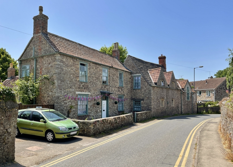
Dated 1648 on porch at rear, altered and extended to south in late C18 and to north WWE in C19. East elevation. To right, C17 building. Rubble. Double Roman tiled roof. One storey and attic in 2 gabled dormers. Two windows; 2-light casements with ovolo moulded stone mullions; glazing bar sash in south gable wall. C19 gabled extension to right with 2-light plate tracery window. To left late C18/early C19 rubble. Double Roman tiled roof. Two storeys. Three glazing bar sash windows. Sixteen panes on ground floor. Central plank door with overlight under flat hood on brackets. Rear (formerly front) elevation: Two 3-light mullion and transom stone casements. Two storey porch with segmental headed door; 2-light 4 centred arch window under hoodmould with returns. Datestone above. Interior: Ovolo moulded and chamfered beams. Rear door consists of studded planks.
Listing NGR: ST6344490435
External links are from the relevant listing authority and, where applicable, Wikidata. Wikidata IDs may be related buildings as well as this specific building. If you want to add or update a link, you will need to do so by editing the Wikidata entry.


Other nearby listed buildings