Latitude: 51.5373 / 51°32'14"N
Longitude: -2.3907 / 2°23'26"W
OS Eastings: 372996
OS Northings: 182120
OS Grid: ST729821
Mapcode National: GBR 0NJ.GF1
Mapcode Global: VH95T.HMZB
Plus Code: 9C3VGJP5+WP
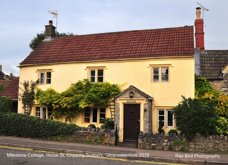
Entry Name: 43, Horse Street
Listing Date: 29 July 1983
Grade: II
Source: Historic England
Source ID: 1313001
English Heritage Legacy ID: 34140
ID on this website: 101313001
Location: Chipping Sodbury, South Gloucestershire, BS37
County: South Gloucestershire
Civil Parish: Sodbury
Built-Up Area: Chipping Sodbury
Traditional County: Gloucestershire
Lieutenancy Area (Ceremonial County): Gloucestershire
Church of England Parish: Chipping Sodbury St John the Baptist
Church of England Diocese: Gloucester
Tagged with: Building
ST 7282 SE SODBURY HORSE STREET
(north side)
5/92
No 43
GV
II
Mid-late C17. Rendered, modern tiled roof, rubble stack. Two storeys. Three
windows; 2- and 3-light casements with ovolo-moulded mullions, dripmould with returned
stops. Single-storey modern porch extension.
Listing NGR: ST7299682120
External links are from the relevant listing authority and, where applicable, Wikidata. Wikidata IDs may be related buildings as well as this specific building. If you want to add or update a link, you will need to do so by editing the Wikidata entry.


Other nearby listed buildings