Approximate Location Map
Large Map »
Latitude: 51.5371 / 51°32'13"N
Longitude: -2.3903 / 2°23'25"W
OS Eastings: 373024
OS Northings: 182097
OS Grid: ST730820
Mapcode National: GBR 0NJ.GJF
Mapcode Global: VH95T.JM6H
Plus Code: 9C3VGJP5+VV
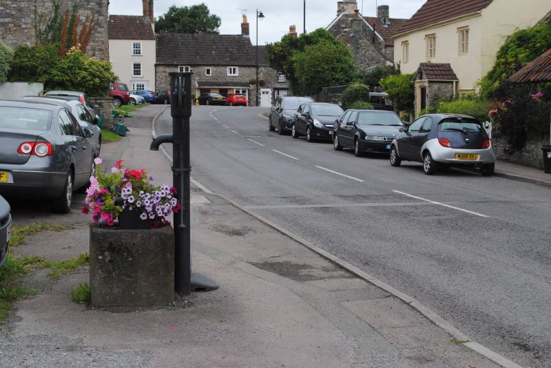
Entry Name: Pump Outside Number 58
Listing Date: 29 July 1983
Grade: II
Source: Historic England
Source ID: 1320873
English Heritage Legacy ID: 34156
ID on this website: 101320873
Location: Chipping Sodbury, South Gloucestershire, BS37
County: South Gloucestershire
Civil Parish: Sodbury
Built-Up Area: Chipping Sodbury
Traditional County: Gloucestershire
Lieutenancy Area (Ceremonial County): Gloucestershire
Church of England Parish: Chipping Sodbury St John the Baptist
Church of England Diocese: Gloucester
Tagged with: Pump
ST 7382 SODBURY HORSE STREET
3/107 (south side)
Pump outside No 58
GV
II
Early C19 cast-iron water pump; stone block adjacent, with basin and overflow hollowed
from top surface.
Listing NGR: ST7302482097
External links are from the relevant listing authority and, where applicable, Wikidata. Wikidata IDs may be related buildings as well as this specific building. If you want to add or update a link, you will need to do so by editing the Wikidata entry.


Other nearby listed buildings
