Approximate Location Map
Large Map »
Latitude: 51.538 / 51°32'16"N
Longitude: -2.3959 / 2°23'45"W
OS Eastings: 372637
OS Northings: 182198
OS Grid: ST726821
Mapcode National: GBR 0NJ.F2Y
Mapcode Global: VH95T.FL7T
Plus Code: 9C3VGJQ3+6J
Entry Name: 12, High Street
Listing Date: 29 July 1983
Grade: II
Source: Historic England
Source ID: 1313049
English Heritage Legacy ID: 34117
ID on this website: 101313049
Location: Chipping Sodbury, South Gloucestershire, BS37
County: South Gloucestershire
Civil Parish: Sodbury
Built-Up Area: Chipping Sodbury
Traditional County: Gloucestershire
Lieutenancy Area (Ceremonial County): Gloucestershire
Church of England Parish: Chipping Sodbury St John the Baptist
Church of England Diocese: Gloucester
Tagged with: Building
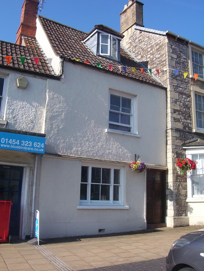
ST 7282 SE SODBURY HIGH STREET
5/70 (south side)
No 12
GV
II
Probably C17 but altered in C19. Rendered. Steeply pitched modern tiled roof. Two
storeys and dormer. One window; large pane sash; tripartite on ground floor. Six
panel door to right.
Listing NGR: ST7263782198
External links are from the relevant listing authority and, where applicable, Wikidata. Wikidata IDs may be related buildings as well as this specific building. If you want to add or update a link, you will need to do so by editing the Wikidata entry.


Other nearby listed buildings
