Approximate Location Map
Large Map »
Latitude: 51.5379 / 51°32'16"N
Longitude: -2.3954 / 2°23'43"W
OS Eastings: 372674
OS Northings: 182189
OS Grid: ST726821
Mapcode National: GBR 0NJ.F7C
Mapcode Global: VH95T.FLJW
Plus Code: 9C3VGJQ3+5V
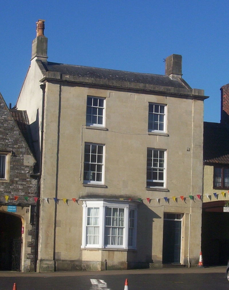
Entry Name: 22, High Street
Listing Date: 29 July 1983
Grade: II
Source: Historic England
Source ID: 1129269
English Heritage Legacy ID: 34121
ID on this website: 101129269
Location: Chipping Sodbury, South Gloucestershire, BS37
County: South Gloucestershire
Civil Parish: Sodbury
Built-Up Area: Chipping Sodbury
Traditional County: Gloucestershire
Lieutenancy Area (Ceremonial County): Gloucestershire
Church of England Parish: Chipping Sodbury St John the Baptist
Church of England Diocese: Gloucester
Tagged with: Building
ST 7282 SE SODBURY HIGH STREET
5/74 (south side)
No 22
GV
II
Late C18/early C19. Painted ashlar. Slate roof behind blocking course. Moulded
cornice. Three storeys. Two windows, glazing bar sashes. Ground floor: bay with
glazing bar sashes. Six panel door with overlight.
Listing NGR: ST7267482189
External links are from the relevant listing authority and, where applicable, Wikidata. Wikidata IDs may be related buildings as well as this specific building. If you want to add or update a link, you will need to do so by editing the Wikidata entry.


Other nearby listed buildings
