Approximate Location Map
Large Map »
Latitude: 51.4768 / 51°28'36"N
Longitude: -0.8638 / 0°51'49"W
OS Eastings: 479001
OS Northings: 175926
OS Grid: SU790759
Mapcode National: GBR C5L.BDZ
Mapcode Global: VHDWV.Z45Q
Plus Code: 9C3XF4GP+PF
Entry Name: Wall to Grove Hall Lodge
Listing Date: 3 May 1984
Grade: II
Source: Historic England
Source ID: 1313085
English Heritage Legacy ID: 41406
ID on this website: 101313085
Location: Twyford, Wokingham, Berkshire, RG10
County: Wokingham
Civil Parish: Twyford
Built-Up Area: Twyford
Traditional County: Berkshire
Lieutenancy Area (Ceremonial County): Berkshire
Church of England Parish: Ruscombe and Twyford
Church of England Diocese: Oxford
Tagged with: Wall
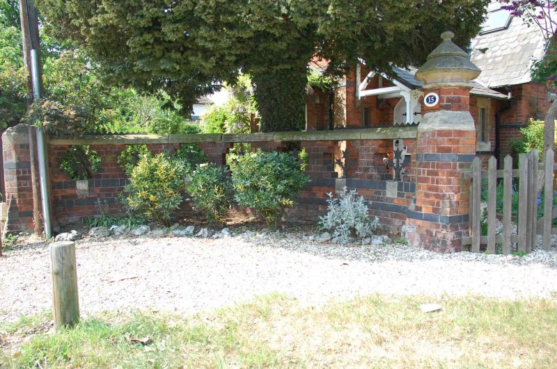
SU 77 NE TWYFORD WALTHAM ROAD
(north side)
2/40 Wall to Grove Hall Lodge
II
Boundary wall. Late C19. Red brick with black bands, stone coping and insets
below 7 open panels with iron decorative spikes. Octagonal brick piers at
each end, the one on right with large moulded conical stone capping. Trite
wall approximately 4 metres long is all that remains of original boundary
wall.
Listing NGR: SU7900175926
External links are from the relevant listing authority and, where applicable, Wikidata. Wikidata IDs may be related buildings as well as this specific building. If you want to add or update a link, you will need to do so by editing the Wikidata entry.


Other nearby listed buildings
