Latitude: 53.5971 / 53°35'49"N
Longitude: -1.7513 / 1°45'4"W
OS Eastings: 416558
OS Northings: 411203
OS Grid: SE165112
Mapcode National: GBR JV6V.N8
Mapcode Global: WHCB8.2VB7
Plus Code: 9C5WH6WX+VF
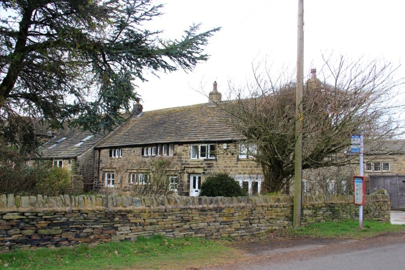
Entry Name: Marsh Hall Farmhouse and Barn
Listing Date: 23 June 1965
Last Amended: 16 May 1984
Grade: II
Source: Historic England
Source ID: 1313325
English Heritage Legacy ID: 341189
ID on this website: 101313325
SE 11 SE MARSH HALL LANE Thurstonland 5/74 Marsh Hall Farmhouse & 23rd June 1965 Barn (formerly listed with Marsh Hall)
G.V. II
Farmhouse with addition, and adjoining barn at 90°. Early or mid C18, altered, addition mid C19. Hammer dressed stone. Quoins. Stone slate roof with gable copings on moulded kneelers. Two storeys. The barn has square cart entry on north side and large outshut on south side. Inside is one central, tie-beam and collar truss with struts, supported on jowelled posts with curved braces. Truss is half-lapped at apex and takes diagonal ridge piece. Two trenched purlins to each pitch. Aisle ties and posts not present in outshut. South gable to house has entrance with deep lintel, and one 3-light window to each floor, each with one mullion removed. Gabled C19 two-storey addition to west.
Listing NGR: SE1655811203
External links are from the relevant listing authority and, where applicable, Wikidata. Wikidata IDs may be related buildings as well as this specific building. If you want to add or update a link, you will need to do so by editing the Wikidata entry.


Other nearby listed buildings