Latitude: 53.5979 / 53°35'52"N
Longitude: -1.7488 / 1°44'55"W
OS Eastings: 416722
OS Northings: 411286
OS Grid: SE167112
Mapcode National: GBR JV7T.5Z
Mapcode Global: WHCB8.3THN
Plus Code: 9C5WH7X2+5F
Entry Name: Blake House
Listing Date: 23 June 1965
Grade: II
Source: Historic England
Source ID: 1183903
English Heritage Legacy ID: 341185
ID on this website: 101183903
Location: Thurstonland, Kirklees, West Yorkshire, HD4
County: Kirklees
Civil Parish: Kirkburton
Traditional County: Yorkshire
Lieutenancy Area (Ceremonial County): West Yorkshire
Church of England Parish: Thurstonland St Thomas
Church of England Diocese: Leeds
Tagged with: House
SE 11 SE MARSH HALL LANE Thurstonland 5/70 Blake House 23rd June 1965
G.V. II
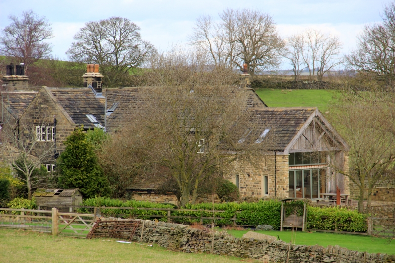
Large farmhouse. Mid C17 with C19 alterations. Deeply coursed hammer dressed stone. Stone slate roof with gable copings on moulded kneelers. Two storeys. Double gabled west side with long range to right. Single, projecting gable to east, which has C19 windows. The west gables have double chamfered windows: one 4-light to each floor with C19 doorway, to right gable. One 5-light window with hood mould to 1st floor of left gable, a large later 2-light window to ground floor and a staircase cross-window. The range to right has C19 openings to both elevations including one 6-light and one 8-light window (the latter with 3 blocked lights), to east elevation 1st floor. This range contains some timber framing and posts. The main parlour in the gabled part of the house has an excellent ceiling with 2 main beams and 3 secondary beams, joists and secondary joists all stop-chamfered.
H. J. Moorhouse, The History of Kirkburton & the Graveship of Holme, 1861.
Listing NGR: SE1672211286
External links are from the relevant listing authority and, where applicable, Wikidata. Wikidata IDs may be related buildings as well as this specific building. If you want to add or update a link, you will need to do so by editing the Wikidata entry.


Other nearby listed buildings