Approximate Location Map
Large Map »
Latitude: 53.6288 / 53°37'43"N
Longitude: -1.7627 / 1°45'45"W
OS Eastings: 415793
OS Northings: 414720
OS Grid: SE157147
Mapcode National: GBR JV4G.5X
Mapcode Global: WHCB7.W1TY
Plus Code: 9C5WJ6HP+GW
Entry Name: 112, Kaye Lane
Listing Date: 29 September 1978
Grade: II
Source: Historic England
Source ID: 1313512
English Heritage Legacy ID: 340040
ID on this website: 101313512
Location: Longley, Kirklees, West Yorkshire, HD5
County: Kirklees
Electoral Ward/Division: Newsome
Parish: Non Civil Parish
Built-Up Area: Huddersfield
Traditional County: Yorkshire
Lieutenancy Area (Ceremonial County): West Yorkshire
Church of England Parish: Almondbury with Farnley Tyas Team Parish
Church of England Diocese: Leeds
Tagged with: Building
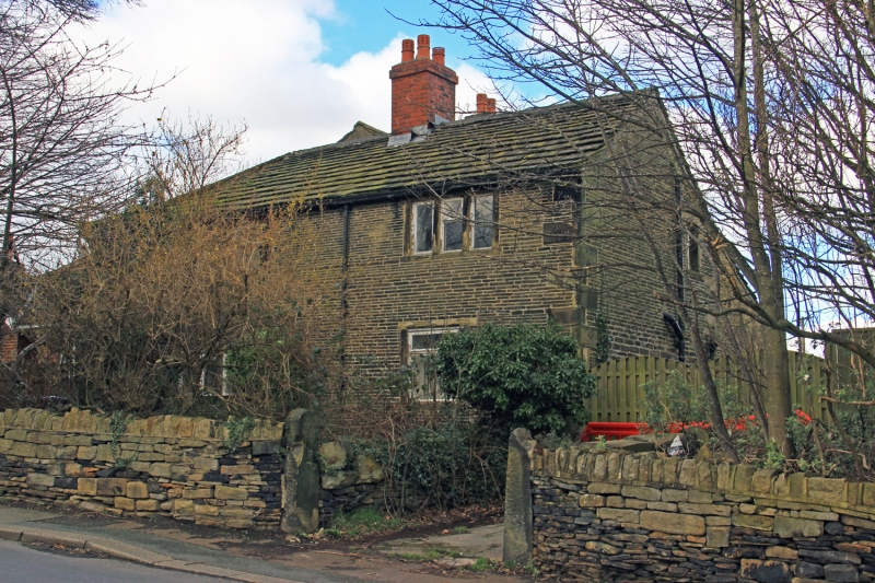
KAYE LANE
1.
5113
(North Side)
No 112
SE 1514 44/711
II
2.
C18. Hammer dressed stone. Hipped stone slate roof. 2 storeys. 1st floor
has 2 casements and one 3-light stone mullioned window. Ground floor has one
4-light stone mullioned window and one casement. Door with 5 moulded panels.
Listing NGR: SE1579314720
External links are from the relevant listing authority and, where applicable, Wikidata. Wikidata IDs may be related buildings as well as this specific building. If you want to add or update a link, you will need to do so by editing the Wikidata entry.


Other nearby listed buildings
