Approximate Location Map
Large Map »
Latitude: 53.6265 / 53°37'35"N
Longitude: -1.7648 / 1°45'53"W
OS Eastings: 415654
OS Northings: 414462
OS Grid: SE156144
Mapcode National: GBR JV3H.QR
Mapcode Global: WHCB7.V3TQ
Plus Code: 9C5WJ6GP+H3
Entry Name: Clough Hall
Listing Date: 29 September 1978
Grade: II
Source: Historic England
Source ID: 1134332
English Heritage Legacy ID: 339708
ID on this website: 101134332
Location: Longley, Kirklees, West Yorkshire, HD4
County: Kirklees
Electoral Ward/Division: Almondbury
Parish: Non Civil Parish
Traditional County: Yorkshire
Lieutenancy Area (Ceremonial County): West Yorkshire
Church of England Parish: Almondbury with Farnley Tyas Team Parish
Church of England Diocese: Leeds
Tagged with: House
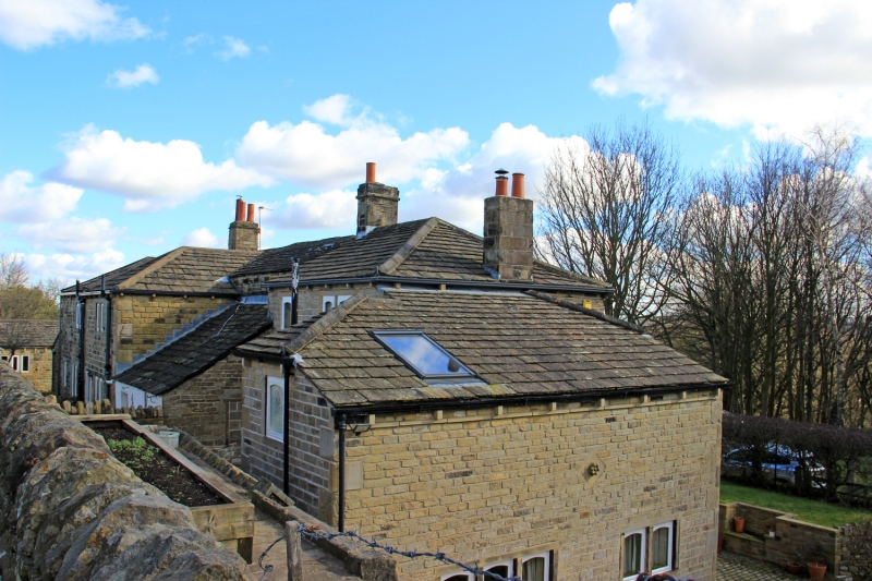
CLOUGH HALL LANE
1.
5113
Almondbury
Nos 1 to 4 (consec)
(Clough Hall)
SE 1514 44/377
II
2.
C18 or early C19. Hammer-dressed stone. South front of Nos 2 and 3, which
breaks forward slightly, is red brick with stone quoins. Hipped stone slate
roof. 2 storeys. 8 ranges of casements.
Listing NGR: SE1565414462
External links are from the relevant listing authority and, where applicable, Wikidata. Wikidata IDs may be related buildings as well as this specific building. If you want to add or update a link, you will need to do so by editing the Wikidata entry.


Other nearby listed buildings
