Approximate Location Map
Large Map »
Latitude: 53.5593 / 53°33'33"N
Longitude: -1.8116 / 1°48'41"W
OS Eastings: 412578
OS Northings: 406976
OS Grid: SE125069
Mapcode National: GBR HWS8.LT
Mapcode Global: WHCBF.4SLS
Plus Code: 9C5WH55Q+P9
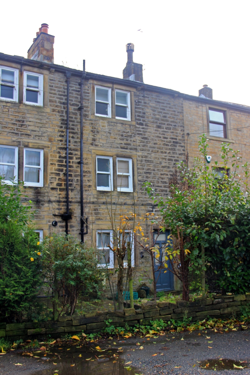
Entry Name: 5, Spring Lane
Listing Date: 4 August 1983
Grade: II
Source: Historic England
Source ID: 1313582
English Heritage Legacy ID: 340528
ID on this website: 101313582
Location: Holmbridge, Kirklees, West Yorkshire, HD9
County: Kirklees
Civil Parish: Holme Valley
Built-Up Area: Holmfirth
Traditional County: Yorkshire
Lieutenancy Area (Ceremonial County): West Yorkshire
Church of England Parish: Holmbridge St David
Church of England Diocese: Leeds
Tagged with: Building
SE 10 NW SPRING LANE
4/301 (Hinchliffe Mill)
No 5
GV
II
Part of row. Early to mid C19. Hammer dressed stone. Stone slate roof. Three
storeys. One 2-light and one 3-light stone mullioned window to all 3 floors. Ground
floor entrance to right.
Listing NGR: SE1257806976
External links are from the relevant listing authority and, where applicable, Wikidata. Wikidata IDs may be related buildings as well as this specific building. If you want to add or update a link, you will need to do so by editing the Wikidata entry.


Other nearby listed buildings
