Approximate Location Map
Large Map »
Latitude: 53.6861 / 53°41'9"N
Longitude: -1.727 / 1°43'37"W
OS Eastings: 418124
OS Northings: 421106
OS Grid: SE181211
Mapcode National: GBR JTCT.WC
Mapcode Global: WHC9W.FMT0
Plus Code: 9C5WM7PF+C5
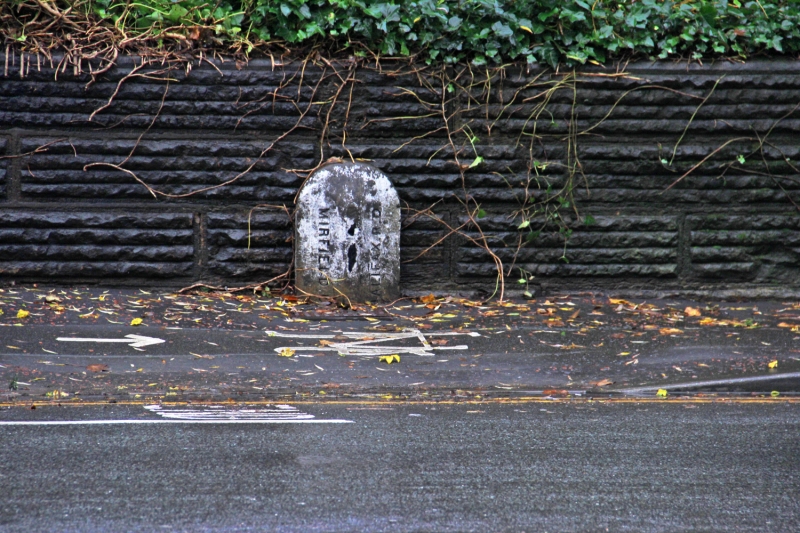
Entry Name: Boundary Stone Opposite Three Nuns Public House
Listing Date: 13 January 1984
Grade: II
Source: Historic England
Source ID: 1313716
English Heritage Legacy ID: 341039
ID on this website: 101313716
Location: Bracken Hill, Kirklees, West Yorkshire, WF14
County: Kirklees
Electoral Ward/Division: Liversedge and Gomersal
Parish: Non Civil Parish
Traditional County: Yorkshire
Lieutenancy Area (Ceremonial County): West Yorkshire
Church of England Parish: Hartsheadst Peter
Church of England Diocese: Leeds
Tagged with: Boundary marker
SE 1813 2110 SPENBOROUGH MB LEEDS ROAD
NUNBROOK
3/132
Boundary Stone opposite
Three Nuns Public House
II
Boundary stone. Late C.19. Stone post with rounded top, inscribed
in capitals. HALIFAX R.D. MIRFIELD U.D. Part buried.
Listing NGR: SE1812421106
External links are from the relevant listing authority and, where applicable, Wikidata. Wikidata IDs may be related buildings as well as this specific building. If you want to add or update a link, you will need to do so by editing the Wikidata entry.


Other nearby listed buildings
