Latitude: 53.6419 / 53°38'30"N
Longitude: -1.7621 / 1°45'43"W
OS Eastings: 415825
OS Northings: 416180
OS Grid: SE158161
Mapcode National: GBR JV4B.96
Mapcode Global: WHCB1.XQ2F
Plus Code: 9C5WJ6RQ+Q5
Entry Name: Bankfield House
Listing Date: 29 September 1978
Grade: II
Source: Historic England
Source ID: 1313768
English Heritage Legacy ID: 339464
ID on this website: 101313768
Location: Moldgreen, Kirklees, West Yorkshire, HD5
County: Kirklees
Electoral Ward/Division: Almondbury
Parish: Non Civil Parish
Built-Up Area: Huddersfield
Traditional County: Yorkshire
Lieutenancy Area (Ceremonial County): West Yorkshire
Church of England Parish: Almondbury with Farnley Tyas Team Parish
Church of England Diocese: Leeds
Tagged with: House
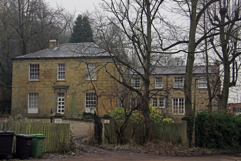
ALMONDBURY BANK
1.
5113
(West Side)
Almondbury
Bankfield House
SE 1516 34/116
II
2.
Mid C19. Ashlar. Hipped slate roof. 2 storeys. Moulded eaves cornice.
3 ranges of sashes. Door with fanlight in moulded frame; moulded cornice above
on moulded consoles.
Listing NGR: SE1582516180
External links are from the relevant listing authority and, where applicable, Wikidata. Wikidata IDs may be related buildings as well as this specific building. If you want to add or update a link, you will need to do so by editing the Wikidata entry.


Other nearby listed buildings