Approximate Location Map
Large Map »
Latitude: 53.6395 / 53°38'22"N
Longitude: -1.7352 / 1°44'6"W
OS Eastings: 417606
OS Northings: 415919
OS Grid: SE176159
Mapcode National: GBR JVBC.42
Mapcode Global: WHCB2.9SZ8
Plus Code: 9C5WJ7Q7+QW
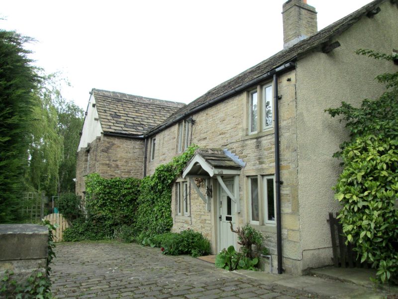
Entry Name: 145-149, Fleming House Lane
Listing Date: 29 September 1978
Grade: II
Source: Historic England
Source ID: 1313870
English Heritage Legacy ID: 339886
ID on this website: 101313870
Location: Cowmes, Kirklees, West Yorkshire, HD5
County: Kirklees
Electoral Ward/Division: Almondbury
Parish: Non Civil Parish
Built-Up Area: Huddersfield
Traditional County: Yorkshire
Lieutenancy Area (Ceremonial County): West Yorkshire
Church of England Parish: Almondbury with Farnley Tyas Team Parish
Church of England Diocese: Leeds
Tagged with: Building
FLEMING HOUSE LANE
1.
5113
(East Side)
Almondbury
Nos 145 to 149 (odd)
SE 1715 40/556
II
2.
C18 or early C19. Hammer-dressed stone. Pitched stone slate roof. 2 storeys.
Projecting wing in centre of rear. Front windows mainly modern, but rear retains
early C19 casements.
Listing NGR: SE1760615919
External links are from the relevant listing authority and, where applicable, Wikidata. Wikidata IDs may be related buildings as well as this specific building. If you want to add or update a link, you will need to do so by editing the Wikidata entry.


Other nearby listed buildings
