Approximate Location Map
Large Map »
Latitude: 53.815 / 53°48'53"N
Longitude: -1.8331 / 1°49'59"W
OS Eastings: 411086
OS Northings: 435421
OS Grid: SE110354
Mapcode National: GBR J0B.10
Mapcode Global: WHC97.TC8Q
Plus Code: 9C5WR578+XQ
Entry Name: 41, Cottingley Road
Listing Date: 9 August 1983
Grade: II
Source: Historic England
Source ID: 1314365
English Heritage Legacy ID: 336327
ID on this website: 101314365
Location: Sandy Lane, Bradford, West Yorkshire, BD15
County: Bradford
Civil Parish: Sandy Lane
Built-Up Area: Bradford
Traditional County: Yorkshire
Lieutenancy Area (Ceremonial County): West Yorkshire
Church of England Parish: Heaton St Martin
Church of England Diocese: Leeds
Tagged with: Building
1.
5111 COTTINGLEY ROAD
Sandy Lane BD15
No 41
SE 13 NW 4/423
II GV
2.
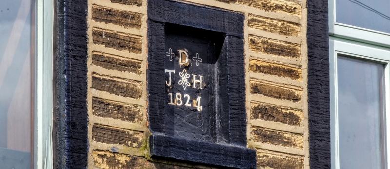
Circa 1840 two-storey small house. Stone "bricks" and stone slate roof with
bracketed eaves; first floor sill band. Three single light framed first floor
windows. Single light and 2 light square mullioned on ground floor. Doorway with
cornice in consoles.
Listing NGR: SE1108635421
External links are from the relevant listing authority and, where applicable, Wikidata. Wikidata IDs may be related buildings as well as this specific building. If you want to add or update a link, you will need to do so by editing the Wikidata entry.


Other nearby listed buildings
