Latitude: 53.3276 / 53°19'39"N
Longitude: -1.1941 / 1°11'38"W
OS Eastings: 453770
OS Northings: 381491
OS Grid: SK537814
Mapcode National: GBR NY3Y.8V
Mapcode Global: WHDF0.MMLB
Plus Code: 9C5W8RH4+29
Entry Name: Chesterfield Canal, Canal Milestone Immediately to West of Milestone Lock
Listing Date: 15 October 1986
Grade: II
Source: Historic England
Source ID: 1314648
English Heritage Legacy ID: 335834
ID on this website: 101314648
Location: Netherthorpe, Rotherham, South Yorkshire, S80
County: Rotherham
Civil Parish: Thorpe Salvin
Traditional County: Yorkshire
Lieutenancy Area (Ceremonial County): South Yorkshire
Church of England Parish: Thorpe Salvin St Peter
Church of England Diocese: Sheffield
Tagged with: Milestone Architectural structure
THORPE SALVIN CHESTERFIELD CANAL SK58SW (south side) SK53778148 Canal milestone 5/86 immediately to west of Milestone Lock GV II
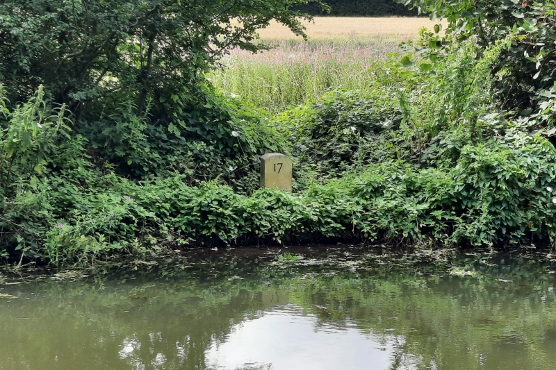
Canal milestone. Late C18-early C19. For the Chesterfield Canal Company. Dressed limestone. Thick round-headed slab with the inscription '17' facing the canal on opposite side to tow-path. Indicates the distance to Chesterfield and may be original to the canal scheme as surveyed by James Brindley and built between 1771 and 1777.
Listing NGR: SK5377081491
External links are from the relevant listing authority and, where applicable, Wikidata. Wikidata IDs may be related buildings as well as this specific building. If you want to add or update a link, you will need to do so by editing the Wikidata entry.


Other nearby listed buildings