Approximate Location Map
Large Map »
Latitude: 53.326 / 53°19'33"N
Longitude: -1.1819 / 1°10'55"W
OS Eastings: 454583
OS Northings: 381317
OS Grid: SK545813
Mapcode National: GBR NY5Z.XG
Mapcode Global: WHDF0.TNCL
Plus Code: 9C5W8RG9+96
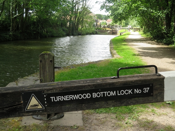
Entry Name: Chesterfield Canal Turnerwood Flight of Locks Between Turnerwood Bridge and Turnerwood Lock at Cinder Hill
Listing Date: 15 October 1986
Grade: II
Source: Historic England
Source ID: 1192731
English Heritage Legacy ID: 335809
ID on this website: 101192731
Location: Netherthorpe, Rotherham, South Yorkshire, S80
County: Rotherham
Civil Parish: North and South Anston
Traditional County: Yorkshire
Lieutenancy Area (Ceremonial County): South Yorkshire
Church of England Parish: Worksop Christ Church and Shireoaks
Church of England Diocese: Southwell and Nottingham
Tagged with: Lock
NORTH AND SOUTH ANSTON CHESTERFIELD CANAL
SK58SW
5/61 Turnerwood Flight of
locks between Turnerwood
Bridge and Turnerwood
Lock at Cinder Hill
GV II
Flight of canal locks. Late C18, some altered. For the Chesterfield Canal
Company. Rubble and ashlar limestone, brick linings. 6 single locks all 2.1
metres in width. Generally the locks have stone entry and exit walls with brick
linings to the locks proper, some with ashlar course visible near low water
line; ashlar lock-gate recesses (gates removed) have hollow-quoined heel-post
housings; stone edgings removed. Although in poorer condition than the Thorpe
Flight of locks to west of Turnerwood Bridge these locks contribute to the sequence of structures on an unspoilt section of waterway in the parishes of Thorpe Salvin and North and South Anston. The canal was surveyed by James Brindley and built between 1771 and 1777 under the supervision of John Varley and Hugh Henshall. Linked Chesterfield with Stockwith to gain access to east waterways. Names and numbers of locks given in:
The Chesterfield Canal, preservation society booklet, 1981.
Listing NGR: SK5458381316
External links are from the relevant listing authority and, where applicable, Wikidata. Wikidata IDs may be related buildings as well as this specific building. If you want to add or update a link, you will need to do so by editing the Wikidata entry.


Other nearby listed buildings
