Latitude: 53.3634 / 53°21'48"N
Longitude: -1.3284 / 1°19'42"W
OS Eastings: 444787
OS Northings: 385374
OS Grid: SK447853
Mapcode National: GBR MY5K.61
Mapcode Global: WHDDR.KQMG
Plus Code: 9C5W9M7C+8J
Entry Name: Cowhouse Flanking East Side of Farm Yard at Park Hill Farm
Listing Date: 21 August 1986
Grade: II
Source: Historic England
Source ID: 1314657
English Heritage Legacy ID: 335889
ID on this website: 101314657
Location: Swallownest, Rotherham, South Yorkshire, S26
County: Rotherham
Civil Parish: Aston cum Aughton
Traditional County: Yorkshire
Lieutenancy Area (Ceremonial County): South Yorkshire
Church of England Parish: Aston cum Aughton All Saints
Church of England Diocese: Sheffield
Tagged with: Cowshed
SK48NW ASTON-CUM-AUGHTON PARK HILL (north side) 5/15 Cowhouse flanking east 21.8.86 side of farm-yeard at Park Hill Farm
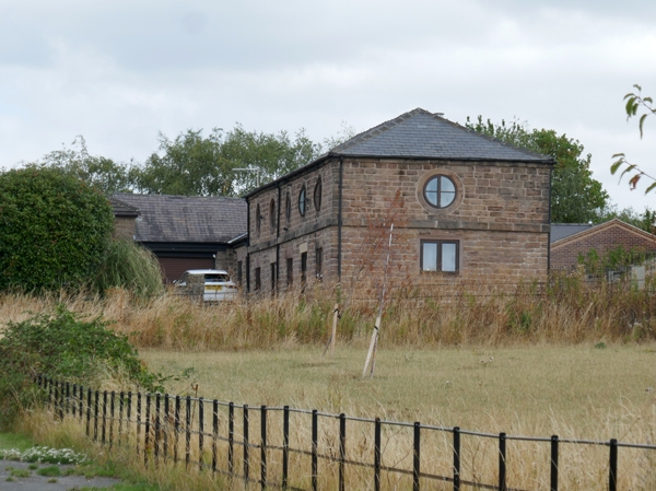
GV II Cowhouse with hayloft. Early-mid C19. Coursed, dressed red sandstone, Welsh slate roof. 2 storeys, 5 bays. Wallstone plinth. Door with wedge lintel to bay 2, altered doorways to bays 1 and 4, windows to bays 3 and 5. 1st-floor band beneath 5 circular pitching holes with dressed surrounds. Eaves band, hipped roof. Rear: 5 pitching holes as front. Left return: blocked triple slit vents to ground floor, matching pitching hole above. Faces contemporary barn and forms important element of U-shaped planned farm group. Included for group value.
Listing NGR: SK4478785374
External links are from the relevant listing authority and, where applicable, Wikidata. Wikidata IDs may be related buildings as well as this specific building. If you want to add or update a link, you will need to do so by editing the Wikidata entry.


Other nearby listed buildings