Latitude: 53.3625 / 53°21'44"N
Longitude: -1.2977 / 1°17'51"W
OS Eastings: 446835
OS Northings: 385294
OS Grid: SK468852
Mapcode National: GBR MYCK.VC
Mapcode Global: WHDDS.1RB4
Plus Code: 9C5W9P62+XW
Entry Name: The Lodge
Listing Date: 1 April 1987
Grade: II
Source: Historic England
Source ID: 1314659
English Heritage Legacy ID: 335894
ID on this website: 101314659
Location: Aston, Rotherham, South Yorkshire, S26
County: Rotherham
Civil Parish: Aston cum Aughton
Built-Up Area: Swallownest
Traditional County: Yorkshire
Lieutenancy Area (Ceremonial County): South Yorkshire
Church of England Parish: Aston cum Aughton All Saints
Church of England Diocese: Sheffield
Tagged with: Gatehouse
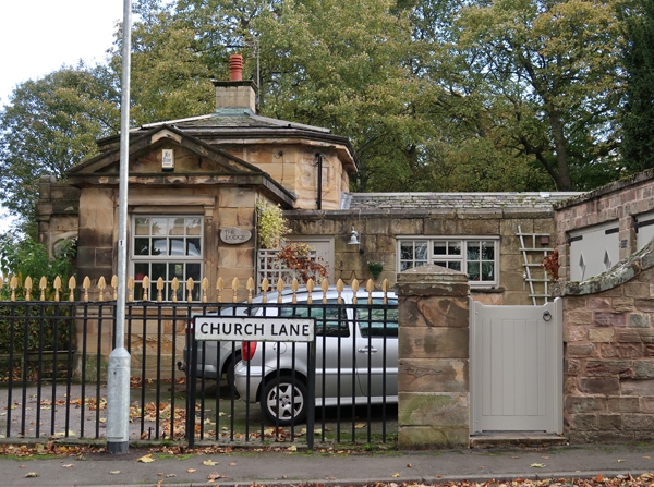
ASTON-CUM-AUGHTON WORKSOP ROAD SK48NE (south side), Aston 6/19 The Lodge GV II Lodge. Mid C19, later additions to rear. For the Aston Hall estate. Ashlar sandstone, graduated slate roof. Octagonal centre with front porch, lower side wings Single storey, 3 bays. Porch has round-headed opening with architrave; flanking pilasters with voluted capitals, geometrically-incised frieze beneath stepped blocking course. Angled side walls have plinths and blocks to sill bands, small C20 casements with sunken-panelled jambs and rackets to stylised entablatures. Band with sunken panels above, cornice to hipped roof with renewed central stack. Side wings; each has a 16-pane sash in recess between ashlar strips, cornice. Returns of side wings as front, pedimented end gables. Former lodge to Aston Hall (now known as Aughton Court q.v.).
Listing NGR: SK4683385291
External links are from the relevant listing authority and, where applicable, Wikidata. Wikidata IDs may be related buildings as well as this specific building. If you want to add or update a link, you will need to do so by editing the Wikidata entry.


Other nearby listed buildings