Latitude: 53.4169 / 53°25'0"N
Longitude: -1.1628 / 1°9'45"W
OS Eastings: 455742
OS Northings: 391452
OS Grid: SK557914
Mapcode National: GBR NXBX.2V
Mapcode Global: WHDDN.3CKV
Plus Code: 9C5WCR8P+QV
Entry Name: Sandbeck Lodge Farmhouse
Listing Date: 13 November 1959
Grade: II
Source: Historic England
Source ID: 1314686
English Heritage Legacy ID: 335939
ID on this website: 101314686
Location: Rotherham, South Yorkshire, S66
County: Rotherham
Civil Parish: Maltby
Traditional County: Yorkshire
Lieutenancy Area (Ceremonial County): South Yorkshire
Church of England Parish: Maltby
Church of England Diocese: Sheffield
Tagged with: Farmhouse
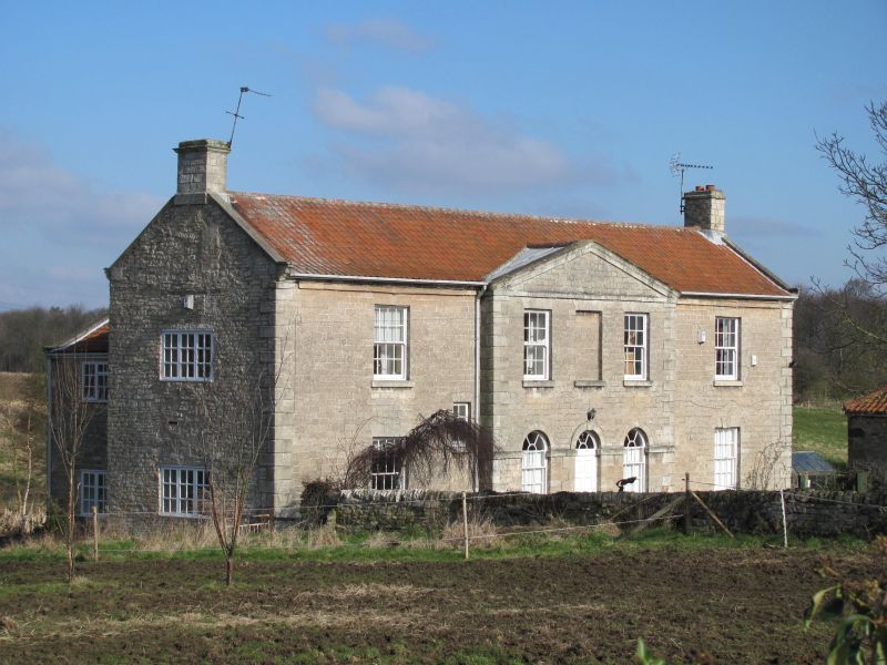
MALTBY SANDBECK PARK SK59SE 4/64 Sandbeck Lodge 13.11.59 Farmhouse GV II Farmhouse. Mid-late C18. For the Sandbeck estate. Coursed, dressed magnesian limestone, pantile roof. 2 storeys, 1:3:1 bays with central bays breaking forward, 3 gabled wings to rear. Plinth, rusticated quoins. Central 6-panel door and fanlight with radial glazing bars in raised, quoined surround with impost band and archivolt with keystone; impost band links to flanking round-headed sashes with glazing bars having projecting sills. Above them sashes with glazing bars flanking a blind window beneath a shallow pediment. Outer bays have a 16-pane sash with projecting sill and flat arch to each floor; small casement with projecting sill and flat arch at mid- height to right of bay 1. Eaves cornice over outer bays, shaped kneelers to coped end gables; corniced end stack on left, end stack an right has band. Rear: central gable has square-headed stair window with keystone to flat arch.
Listing NGR: SK5574291452
External links are from the relevant listing authority and, where applicable, Wikidata. Wikidata IDs may be related buildings as well as this specific building. If you want to add or update a link, you will need to do so by editing the Wikidata entry.


Other nearby listed buildings