Latitude: 54.4134 / 54°24'48"N
Longitude: -1.2675 / 1°16'3"W
OS Eastings: 447633
OS Northings: 502246
OS Grid: NZ476022
Mapcode National: GBR MKLD.CP
Mapcode Global: WHD7R.HBMF
Plus Code: 9C6WCP7J+9X
Entry Name: Pinfold to South of Maynard Bridge
Listing Date: 30 October 1990
Grade: II
Source: Historic England
Source ID: 1314940
English Heritage Legacy ID: 333230
ID on this website: 101314940
Location: Swainby, North Yorkshire, DL6
County: North Yorkshire
District: Hambleton
Civil Parish: Whorlton
Built-Up Area: Swainby
Traditional County: Yorkshire
Lieutenancy Area (Ceremonial County): North Yorkshire
Church of England Parish: Whorlton
Church of England Diocese: York
Tagged with: Animal pound
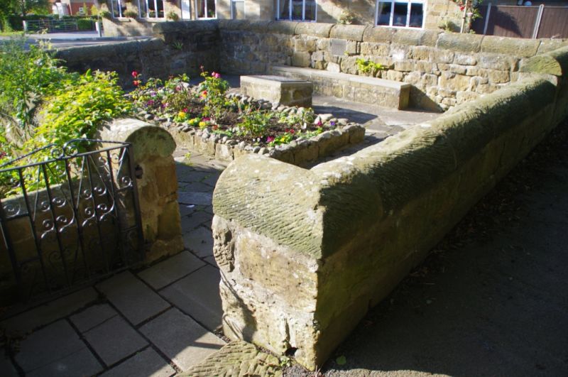
NZ 40 SE WHORLTON HIGH STREET Swainby West side 9/171 Pinfold to south of Maynard Bridge II Pinfold, C18 or earlier. Roughly-coursed large sandstone blocks. Heavy, tooled-and-margined half-round coping. Wrought iron gate. Square enclosure with walls stepped down from north to south. C20 gate. Centre now planted with roses. Plaque on North wall: To commemorate the conversion by voluntary labour of this ancient pinfold in 1972-3. Once the property of the Lords of the Manor it was tranferred, together with manorial rights, to the parish of Whorlton by Miss Winifred Walker of Kirkby-in-Cleveland in 1967. Included for historical interest.
Listing NGR: NZ4763302246
External links are from the relevant listing authority and, where applicable, Wikidata. Wikidata IDs may be related buildings as well as this specific building. If you want to add or update a link, you will need to do so by editing the Wikidata entry.


Other nearby listed buildings