Latitude: 54.1261 / 54°7'33"N
Longitude: -0.7268 / 0°43'36"W
OS Eastings: 483300
OS Northings: 470774
OS Grid: SE833707
Mapcode National: GBR RNCQ.FN
Mapcode Global: WHFBH.TK27
Plus Code: 9C6X47GF+C7
Entry Name: Inn House Farmhouse and Attached Outbuilding
Listing Date: 10 October 1966
Last Amended: 25 April 1986
Grade: II
Source: Historic England
Source ID: 1315807
English Heritage Legacy ID: 329764
ID on this website: 101315807
Location: Settrington, North Yorkshire, YO17
County: North Yorkshire
District: Ryedale
Civil Parish: Settrington
Built-Up Area: Settrington
Traditional County: Yorkshire
Lieutenancy Area (Ceremonial County): North Yorkshire
Church of England Parish: West Buckrose
Church of England Diocese: York
Tagged with: Farmhouse
SE 8370
10/82
10.10.66
SETTRINGTON
VILLAGE STREET
(east side)
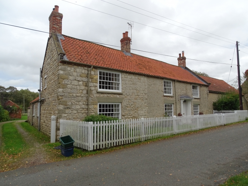
Inn House Farmhouse and attached outbuilding
(Formerly listed as Inn House Farmhouse and cottage N of Inn Farmhouse)
GV
II
2 cottages, remodelled as inn in C19, now farmhouse. Mid C18 incorporating
portion of an earlier building; late C19 remodelling. Squared limestone on
limestone rubble plinth; brick eaves course; pantile roof with rebuilt brick
stacks. 2-storey, 3-window front, with 1 1/2-storey outbuilding to right and
extension to rear. Centre right panelled door with overlight beneath
bracketed porch, flanked by 20-pane sashes to ground and first floors; 28-
pane sashes to both floors to left. Painted stone sills to all windows, and
painted wedge lintels to ground-floor windows; thin timber lintels to first-
floor windows. Outbuilding has window with vertical bars between a stable
door and board door, and 12-pane sash at end right, all with thin timber
lintels. End and centre left stacks to house.
Listing NGR: SE8330070774
External links are from the relevant listing authority and, where applicable, Wikidata. Wikidata IDs may be related buildings as well as this specific building. If you want to add or update a link, you will need to do so by editing the Wikidata entry.


Other nearby listed buildings