Approximate Location Map
Large Map »
Latitude: 54.1333 / 54°7'59"N
Longitude: -1.5203 / 1°31'12"W
OS Eastings: 431443
OS Northings: 470929
OS Grid: SE314709
Mapcode National: GBR KNTN.N3
Mapcode Global: WHC7V.MC8Q
Plus Code: 9C6W4FMH+8V
Entry Name: Brewers Arms
Listing Date: 12 October 1977
Grade: II
Source: Historic England
Source ID: 1315835
English Heritage Legacy ID: 330012
ID on this website: 101315835
Location: Bondgate, North Yorkshire, HG4
County: North Yorkshire
District: Harrogate
Civil Parish: Ripon
Built-Up Area: Ripon
Traditional County: Yorkshire
Lieutenancy Area (Ceremonial County): North Yorkshire
Church of England Parish: Ripon Cathedral Parish with Littlethorpe
Church of England Diocese: Leeds
Tagged with: Pub
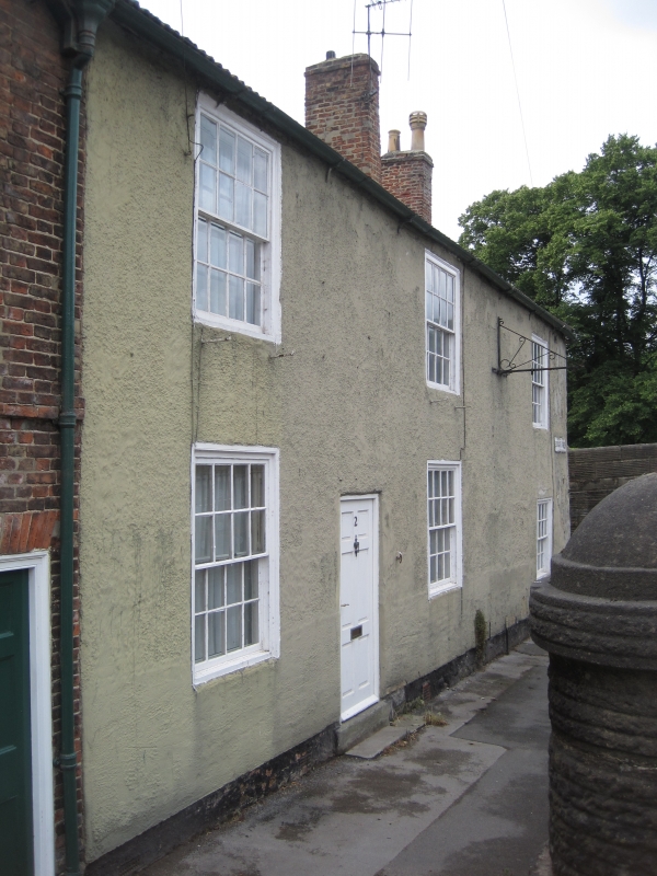
SE 3170 RIPON BONDGATE GREEN
5/128 (south side)
12.10.77
Brewers Arms
GV
II
C18. Colour-washed brick. Pantiled roof. Two storeys. Three bays: sashes with
glazing bars.
Listing NGR: SE3144370929
External links are from the relevant listing authority and, where applicable, Wikidata. Wikidata IDs may be related buildings as well as this specific building. If you want to add or update a link, you will need to do so by editing the Wikidata entry.


Other nearby listed buildings
