Approximate Location Map
Large Map »
Latitude: 54.4173 / 54°25'2"N
Longitude: -0.9499 / 0°56'59"W
OS Eastings: 468243
OS Northings: 502940
OS Grid: NZ682029
Mapcode National: GBR PKTC.48
Mapcode Global: WHF91.C7XF
Plus Code: 9C6XC382+W3
Entry Name: Boundary Stone on Border with Westerdale County Parish
Listing Date: 20 December 1990
Grade: II
Source: Historic England
Source ID: 1316260
English Heritage Legacy ID: 327964
ID on this website: 101316260
Location: Danby Head, North Yorkshire, YO21
County: North Yorkshire
District: Scarborough
Civil Parish: Danby
Traditional County: Yorkshire
Lieutenancy Area (Ceremonial County): North Yorkshire
Church of England Parish: Westerdale Christ Church
Church of England Diocese: York
Tagged with: Boundary marker
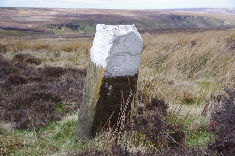
NZ 60 SE DANBY DANBY HIGH MOOR
6825-0291
10/46 Boundary stone
on border with
Westerdale C.P.
II
Boundary stone, early-mid C19. Hard sandstone. Square stone about
lm. high and 0.2m. square. Inscribed D (for Danby) on north and
W (for Westerdale) on south, with 0.S.B.M.
Listing NGR: NZ6824302940
External links are from the relevant listing authority and, where applicable, Wikidata. Wikidata IDs may be related buildings as well as this specific building. If you want to add or update a link, you will need to do so by editing the Wikidata entry.


Other nearby listed buildings
