Approximate Location Map
Large Map »
Latitude: 54.4855 / 54°29'7"N
Longitude: -0.6163 / 0°36'58"W
OS Eastings: 489736
OS Northings: 510897
OS Grid: NZ897108
Mapcode National: GBR SJ4K.CV
Mapcode Global: WHG9Y.HJQ6
Plus Code: 9C6XF9PM+5F
Entry Name: 46 and 47, Baxtergate
Listing Date: 4 December 1972
Grade: II
Source: Historic England
Source ID: 1316373
English Heritage Legacy ID: 326544
ID on this website: 101316373
Location: Whitby, North Yorkshire, YO21
County: North Yorkshire
District: Scarborough
Civil Parish: Whitby
Built-Up Area: Whitby
Traditional County: Yorkshire
Lieutenancy Area (Ceremonial County): North Yorkshire
Church of England Parish: Whitby St Mary
Church of England Diocese: York
Tagged with: Building
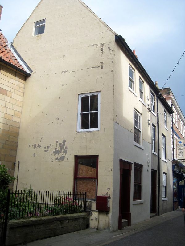
l.
1811 BAXTERGATE
(North Side)
Nos 46 & 47
NZ 8910 3/47
II GV
2.
C18. 3 storeys, rendered. 3 double hung sash windows, 4 on top floor
without glazing bars. Stone eaves, central open passage, tall gable end.
Traces of blocked stone mullioned windows to rear. 2-storey extension
to rear of No 47.
Nos 44 to 47 (consec) and Nos 48A and 48B form a group.
Listing NGR: NZ8973610897
External links are from the relevant listing authority and, where applicable, Wikidata. Wikidata IDs may be related buildings as well as this specific building. If you want to add or update a link, you will need to do so by editing the Wikidata entry.


Other nearby listed buildings
