Latitude: 53.2117 / 53°12'42"N
Longitude: -1.6806 / 1°40'50"W
OS Eastings: 421427
OS Northings: 368344
OS Grid: SK214683
Mapcode National: GBR 57S.MXX
Mapcode Global: WHCD7.4JZN
Plus Code: 9C5W6869+MQ
Entry Name: Mayfield Cottage and Westfield Cottage
Listing Date: 20 May 1974
Last Amended: 5 December 1997
Grade: II
Source: Historic England
Source ID: 1316513
English Heritage Legacy ID: 468221
ID on this website: 101316513
Location: Bakewell, Derbyshire Dales, Derbyshire, DE45
County: Derbyshire
District: Derbyshire Dales
Civil Parish: Bakewell
Built-Up Area: Bakewell
Traditional County: Derbyshire
Lieutenancy Area (Ceremonial County): Derbyshire
Church of England Parish: Bakewell All Saints
Church of England Diocese: Derby
Tagged with: Cottage
BAKEWELL
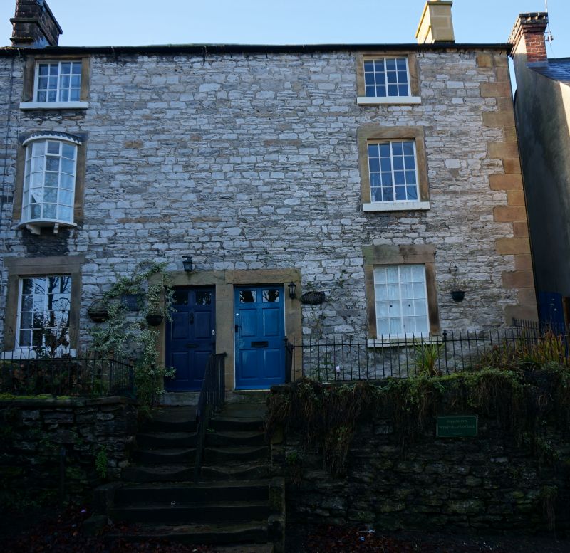
SK2168 YELD ROAD 831-1/4/182 (West side) 20/05/74 Mayfield Cottage and Westfield Cottage (Formerly Listed as: CEMETERY ROAD (West side) Mayfield Cottage and Cottage adjoing Mayfield Cottage to the North)
GV II
Pair of houses. Late C18. Irregularly coursed limestone with ashlar sandstone dressings; tile roof. EXTERIOR: handed 3-storey pair having central doorways and one window to each house on each floor. Linked ashlar surrounds to doors of 6 fielded panels, the topmost panels glazed. Painted projecting sills and ashlar surrounds to horizontally-sliding casements with glazing bars. First-floor window of Mayfield Cottage (on left) has later bow window which extends below the original sill level. Ashlar end stack on right; later stone end stack on left. INTERIOR: not inspected.
Listing NGR: SK2142768344
External links are from the relevant listing authority and, where applicable, Wikidata. Wikidata IDs may be related buildings as well as this specific building. If you want to add or update a link, you will need to do so by editing the Wikidata entry.


Other nearby listed buildings