Latitude: 54.1497 / 54°8'59"N
Longitude: -2.2963 / 2°17'46"W
OS Eastings: 380746
OS Northings: 472697
OS Grid: SD807726
Mapcode National: GBR DNDG.N6
Mapcode Global: WH950.PYRM
Plus Code: 9C6V4PX3+VF
Entry Name: New Inn Bridge
Listing Date: 23 November 1988
Grade: II
Source: Historic England
Source ID: 1316781
English Heritage Legacy ID: 324544
ID on this website: 101316781
Location: Horton in Ribblesdale, North Yorkshire, BD24
County: North Yorkshire
District: Craven
Civil Parish: Horton in Ribblesdale
Traditional County: Yorkshire
Lieutenancy Area (Ceremonial County): North Yorkshire
Church of England Parish: Horton-in-Ribblesdale St Oswald
Church of England Diocese: Leeds
Tagged with: Bridge
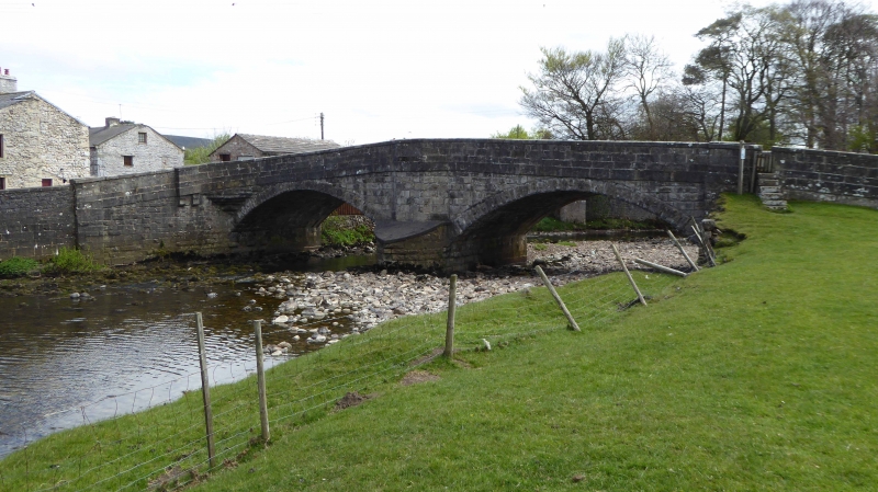
HORTON IN RIBBLESDALE MAIN STREET SD 8072-8172 15/8 New Inn Bridge - GV II Road bridge. Late C18. Dressed stone. 2 span segmental arches. Central angular cutwater to south, central and flanking pilasters. String course to base of parapet and wing walls, coping to walls with moulded caps to pilasters. Segmental pointed curve to north cutwater with canted bay above for pedestrians. Stile with steps in north parapet.
Listing NGR: SD8074672697
External links are from the relevant listing authority and, where applicable, Wikidata. Wikidata IDs may be related buildings as well as this specific building. If you want to add or update a link, you will need to do so by editing the Wikidata entry.


Other nearby listed buildings