Latitude: 54.2909 / 54°17'27"N
Longitude: -2.2601 / 2°15'36"W
OS Eastings: 383165
OS Northings: 488392
OS Grid: SD831883
Mapcode National: GBR DLNT.HL
Mapcode Global: WHB5L.8D0W
Plus Code: 9C6V7PRQ+8X
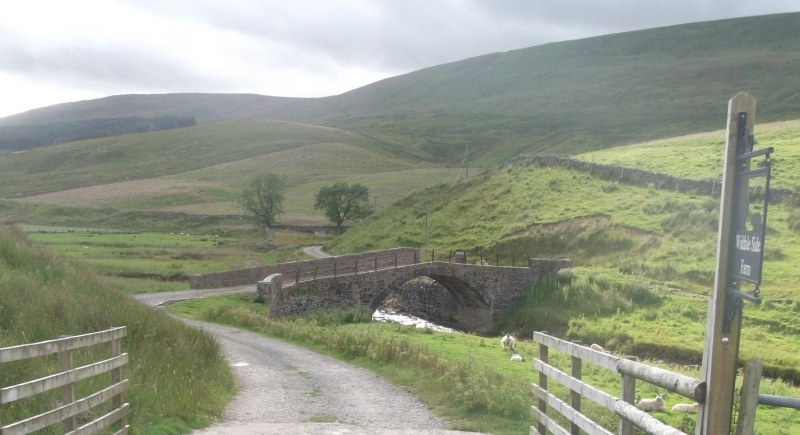
Entry Name: Bridge on Track Leading to Widdale Side
Listing Date: 9 July 1986
Grade: II
Source: Historic England
Source ID: 1316899
English Heritage Legacy ID: 323164
ID on this website: 101316899
Location: North Yorkshire, DL8
County: North Yorkshire
District: Richmondshire
Civil Parish: Hawes
Traditional County: Yorkshire
Lieutenancy Area (Ceremonial County): North Yorkshire
Tagged with: Bridge
SD 88 NW
11/141
HAWES
WIDDALE
Bridge on track leading to Widdale Side
II
Bridge. Mid - late C19. Rubble. Single segmental arch of rubble voussoir.
Parapets partly replaced by metal fencing.
Listing NGR: SD8316588392
External links are from the relevant listing authority and, where applicable, Wikidata. Wikidata IDs may be related buildings as well as this specific building. If you want to add or update a link, you will need to do so by editing the Wikidata entry.


Other nearby listed buildings