Latitude: 53.9559 / 53°57'21"N
Longitude: -1.9406 / 1°56'26"W
OS Eastings: 403992
OS Northings: 451093
OS Grid: SE039510
Mapcode National: GBR GQWP.NN
Mapcode Global: WHB79.5T4P
Plus Code: 9C5WX345+9P
Entry Name: Guide Post (At Ngr Se 03995109)
Listing Date: 2 November 1987
Grade: II
Source: Historic England
Source ID: 1317055
English Heritage Legacy ID: 323910
ID on this website: 101317055
Location: North Yorkshire, BD20
County: North Yorkshire
District: Craven
Civil Parish: Draughton
Traditional County: Yorkshire
Lieutenancy Area (Ceremonial County): West Yorkshire
Tagged with: Milestone Fingerpost
SE 05 SW
8/1
DRAUGHTON
HEIGHT LANE
(east side)
Guide Post
(at NGR SE 03995109)
II
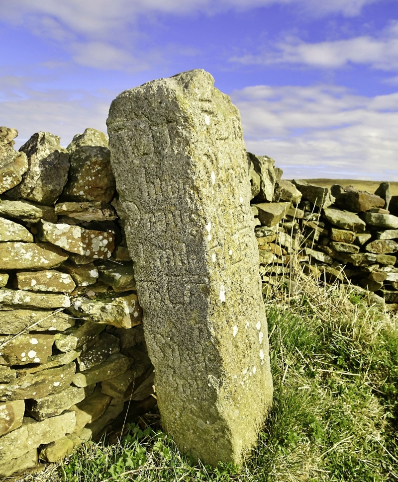
Guidepost. c1740. Millstone grit post, c 1.2 metres tall. Square in section with
segmental arched head. Inscribed on 2 faces:
South face: West face:
to to
Skipton Draughton
3 Mes 1 mile
to to
Addingham Silsden
2 Mes 3 Mes
Listing NGR: SE0399251093
External links are from the relevant listing authority and, where applicable, Wikidata. Wikidata IDs may be related buildings as well as this specific building. If you want to add or update a link, you will need to do so by editing the Wikidata entry.


Other nearby listed buildings