Approximate Location Map
Large Map »
Latitude: 51.4849 / 51°29'5"N
Longitude: -0.5215 / 0°31'17"W
OS Eastings: 502756
OS Northings: 177248
OS Grid: TQ027772
Mapcode National: GBR G9V.T49
Mapcode Global: VHFT9.XY52
Plus Code: 9C3XFFMH+W9
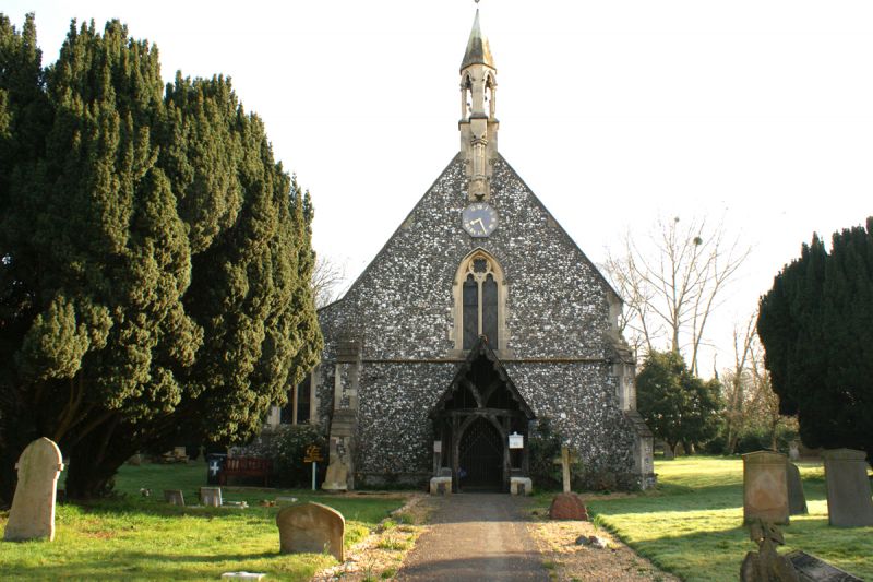
Entry Name: Church of St Thomas
Listing Date: 26 April 1985
Grade: II
Source: Historic England
Source ID: 1317589
English Heritage Legacy ID: 44193
ID on this website: 101317589
Location: St Thomas' Church, Colnbrook, Slough, Berkshire, SL3
County: Slough
Civil Parish: Colnbrook with Poyle
Built-Up Area: Poyle
Traditional County: Buckinghamshire
Lieutenancy Area (Ceremonial County): Berkshire
Church of England Parish: Colnbrook
Church of England Diocese: Oxford
Tagged with: Church building
TQ 0277 IVER VICARAGE WAY
Colnbrook
22/572
Church of St Thomas
-
GV II
1849-52, by Benjamin Ferrey. Flint with stone dressings; slate roof. Small
stone bellcote on west gable end. Timber-framed open porch. Screen of 1886, by
Basil Champneys.
Listing NGR: TQ0275677248
External links are from the relevant listing authority and, where applicable, Wikidata. Wikidata IDs may be related buildings as well as this specific building. If you want to add or update a link, you will need to do so by editing the Wikidata entry.


Other nearby listed buildings
