Latitude: 53.8434 / 53°50'36"N
Longitude: -0.4302 / 0°25'48"W
OS Eastings: 503384
OS Northings: 439720
OS Grid: TA033397
Mapcode National: GBR TRFZ.NZ
Mapcode Global: WHGF4.CNDD
Plus Code: 9C5XRHV9+9W
Entry Name: Walkergate House
Listing Date: 1 March 1950
Grade: II
Source: Historic England
Source ID: 1317700
English Heritage Legacy ID: 167505
ID on this website: 101317700
Location: Beverley, East Riding of Yorkshire, HU17
County: East Riding of Yorkshire
Civil Parish: Beverley
Built-Up Area: Beverley
Traditional County: Yorkshire
Lieutenancy Area (Ceremonial County): East Riding of Yorkshire
Church of England Parish: Beverley St Mary
Church of England Diocese: York
Tagged with: House
TA0339 BEVERLEY WALKERGATE (east side) 9/374 No 67 (Walkergate House) - 1.3.50
GV II
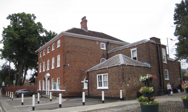
Circa 1780. 3 storeys in red brick with plain tile roof and painted wood ogee bracketed eaves cornice. Painted stone base to house and cill string to ground floor windows. 5 windows, resashed in plate glass, gauged flat arches to near flush frames. Wood doorcase with architrave, chambranles, frieze with centre tablet, enriched consoles, dentil pediment. Door of 6 panels and fanlight. The garden front of the house is similar to the street front and there is an incon- spicuous service wing. The Drawing Room contains some good 'Adam' stucco panel- ling and decoration.
Listing NGR: TA0338439720
External links are from the relevant listing authority and, where applicable, Wikidata. Wikidata IDs may be related buildings as well as this specific building. If you want to add or update a link, you will need to do so by editing the Wikidata entry.


Other nearby listed buildings