Latitude: 53.9772 / 53°58'38"N
Longitude: -2.7896 / 2°47'22"W
OS Eastings: 348312
OS Northings: 453752
OS Grid: SD483537
Mapcode National: GBR 8QYG.V0
Mapcode Global: WH84M.39XB
Plus Code: 9C5VX6G6+V5
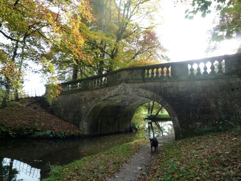
Entry Name: Ellel Grange Bridge (NO.84)
Listing Date: 7 March 1985
Grade: II
Source: Historic England
Source ID: 1317881
English Heritage Legacy ID: 182155
ID on this website: 101317881
Location: Hampson Green, Lancaster, Lancashire, LA2
County: Lancashire
District: Lancaster
Civil Parish: Ellel
Traditional County: Lancashire
Lieutenancy Area (Ceremonial County): Lancashire
Church of England Parish: Ellel St John The Evangelist
Church of England Diocese: Blackburn
Tagged with: Bridge
SD 45 SE ELLEL
12/82 Ellel Grange Bridge (No.84)
-
- II
Accommodation bridge over Lancaster Canal, opened 1797. Engineer John Rennie.
Parapet probably altered c.1860. Punched sandstone blocks. Single elliptical
arch with stepped keystone. Band below ashlar parapet with openings each
filled by 5 balusters. Weathered coping.
Listing NGR: SD4831253752
External links are from the relevant listing authority and, where applicable, Wikidata. Wikidata IDs may be related buildings as well as this specific building. If you want to add or update a link, you will need to do so by editing the Wikidata entry.


Other nearby listed buildings