Latitude: 53.9773 / 53°58'38"N
Longitude: -2.793 / 2°47'34"W
OS Eastings: 348086
OS Northings: 453764
OS Grid: SD480537
Mapcode National: GBR 8QYF.3Z
Mapcode Global: WH84M.2988
Plus Code: 9C5VX6G4+WQ
Entry Name: Ellel Grange
Listing Date: 7 June 1979
Grade: II
Source: Historic England
Source ID: 1317896
English Heritage Legacy ID: 182153
ID on this website: 101317896
Location: Hampson Green, Lancaster, Lancashire, LA2
County: Lancashire
District: Lancaster
Civil Parish: Ellel
Traditional County: Lancashire
Lieutenancy Area (Ceremonial County): Lancashire
Church of England Parish: Ellel St John The Evangelist
Church of England Diocese: Blackburn
Tagged with: Building
SD 45 SE ELLEL
12/80 Ellel Grange 7-6-1979
GV II
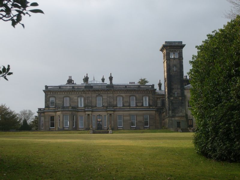
Country house, now hydro, 1857-9, probably by John Weightman, for William Preston. Sandstone ashlar with slate roofs. Italian villa style. 2 storeys. Ground floor has channelled rustication; and a cornice over. 1st floor has rusticated quoins and a bracketed cornice with balustrade. Windows sashed with no glazing bars, and architraves, those on the 1st floor with segmental heads. North-west, entrance, front has 3-storey tower. To its left are 2 bays, the ground floor having a tripartite window flanked by smaller windows. To the right and set back are 3 bays. Tower has rusticated corner pilaster strips and a bracketed cornice. On the 2nd floor there is a 3-light window on each side. Its 1st floor window has a cornice on brackets. The doorway has a segmental head and is flanked by paired rusticated Tuscan columns. Above the entablature is a coat of arms. The south-west facade is of 4 bays, the outer bays projecting and with a bay window in the right-hand bay. The south-east facade is of 7 bays, the central bay flanked by paired antae on the ground floor, and with a single-storey canted bay window in the 2nd bay. Protecting forwards to the right is a tall slim tower withy a battered rusticated basement storey, rusticated corner pilaster strips, and paired round-headed windows on each side under a cornice. Interior not fully accessible at time of survey, but large entrance hall contains columns and antae of red granite, plasterwork, and an Imperial stair with cast iron balustrade.
Listing NGR: SD4808653764
External links are from the relevant listing authority and, where applicable, Wikidata. Wikidata IDs may be related buildings as well as this specific building. If you want to add or update a link, you will need to do so by editing the Wikidata entry.


Other nearby listed buildings