Approximate Location Map
Large Map »
Latitude: 53.9004 / 53°54'1"N
Longitude: -2.7761 / 2°46'33"W
OS Eastings: 349104
OS Northings: 445196
OS Grid: SD491451
Mapcode National: GBR 9R1B.SK
Mapcode Global: WH850.B796
Plus Code: 9C5VW62F+5H
Entry Name: Wheatsheaf Inn
Listing Date: 9 January 1986
Grade: II
Source: Historic England
Source ID: 1318180
English Heritage Legacy ID: 185496
Also known as: Wheatsheaf
The Wheatsheaf, Preston
ID on this website: 101318180
Location: Garstang, Wyre, Lancashire, PR3
County: Lancashire
District: Wyre
Civil Parish: Garstang
Built-Up Area: Garstang
Traditional County: Lancashire
Lieutenancy Area (Ceremonial County): Lancashire
Church of England Parish: Garstang St Thomas
Church of England Diocese: Blackburn
GARSTANG BACK LANE
SO 44 NE
4/103 Wheatsheaf Inn
-
- II
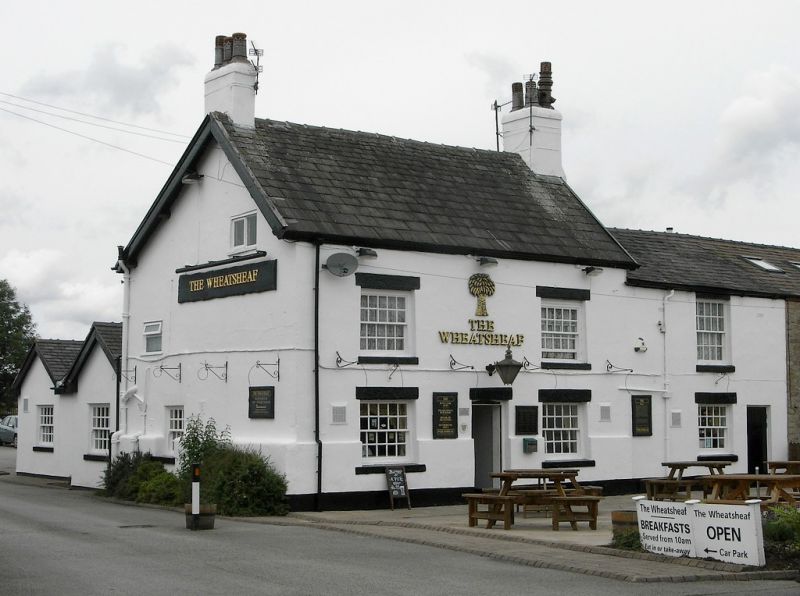
Public house, late C18. Rendered with slate roof. 2 storeys, 2 bays.
Windows sashed with glazing bars and rendered reveals. Door, between bays,
has rendered surround. Gable chimneys.
Listing NGR: SD4910445196
External links are from the relevant listing authority and, where applicable, Wikidata. Wikidata IDs may be related buildings as well as this specific building. If you want to add or update a link, you will need to do so by editing the Wikidata entry.


Other nearby listed buildings
