Latitude: 53.8998 / 53°53'59"N
Longitude: -2.7744 / 2°46'27"W
OS Eastings: 349210
OS Northings: 445122
OS Grid: SD492451
Mapcode National: GBR 9R2B.4S
Mapcode Global: WH850.C72Q
Plus Code: 9C5VV6XG+W6
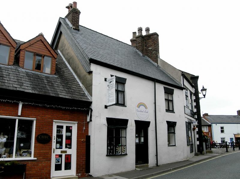
Entry Name: 4, Bridge Street
Listing Date: 17 April 1967
Grade: II
Source: Historic England
Source ID: 1318186
English Heritage Legacy ID: 185499
ID on this website: 101318186
Location: Garstang, Wyre, Lancashire, PR3
County: Lancashire
District: Wyre
Civil Parish: Garstang
Built-Up Area: Garstang
Traditional County: Lancashire
Lieutenancy Area (Ceremonial County): Lancashire
Church of England Parish: Garstang St Thomas
Church of England Diocese: Blackburn
Tagged with: Building
GARSTANG BRIDGE STREET SD 44 NE 4/106 No.4 17-4-1967 GV II Shop, probably mid or late C18, altered. Rendered with brick chimneys and corrugated sheet roof. 2 storeys, 2 bays. Windows modern with rendered reveals. Left-hand bay has bow window on ground floor. Door, between bays, has rendered reveals. End chimneys.
Listing NGR: SD4921045122
External links are from the relevant listing authority and, where applicable, Wikidata. Wikidata IDs may be related buildings as well as this specific building. If you want to add or update a link, you will need to do so by editing the Wikidata entry.


Other nearby listed buildings