Latitude: 54.3286 / 54°19'42"N
Longitude: -2.743 / 2°44'34"W
OS Eastings: 351778
OS Northings: 492808
OS Grid: SD517928
Mapcode National: GBR 9L8D.Y3
Mapcode Global: WH82W.VG0H
Plus Code: 9C6V87H4+CR
Entry Name: Friends Meeting House
Listing Date: 24 April 1951
Grade: II*
Source: Historic England
Source ID: 1319001
English Heritage Legacy ID: 75492
Also known as: Friends Meeting House, Kendal
ID on this website: 101319001
Location: Kendal, Westmorland and Furness, Cumbria, LA9
County: Westmorland and Furness
District: South Lakeland
Civil Parish: Kendal
Built-Up Area: Kendal
Traditional County: Westmorland
Lieutenancy Area (Ceremonial County): Cumbria
Church of England Parish: Kendal St George
Church of England Diocese: Carlisle
Tagged with: Quaker meeting house
SD 5192 NE KENDAL STRAMONGATE (Off South side)
8/146 Friends' Meeting 24-4-51 House
G.V. II*
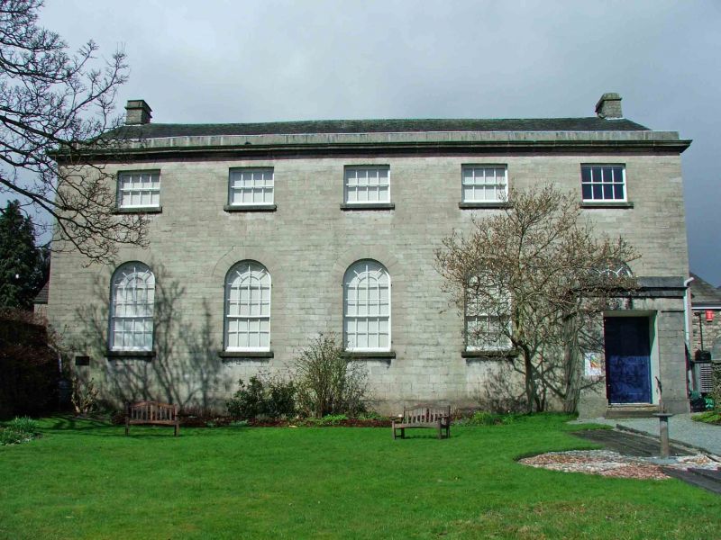
Meeting House. 1816 (built partly on site of late C17 Meeting House) by Francis Webster. Altered internally in 1934, extended eastward in 1936. Hammer-dressed limestone blocks on plinth; eaves cornice and blocking course. Graduated slate roofs with parallel ridges; stone end chimneys. 2 storeys, 5 bays. Stramongate elevation: Porch on left has lunette immediately above and 2 semicircular-headed sashes to right; three 1st floor windows are 1934 insertions. New Street elevation: Porch on right has lunette immediately above and 4 semicircular-headed sashes to left; five lst floor sashes. Tall tripartite sash to west return. Both porches have cornices and blocking courses, with panelled inner double doors. All windows have glazing bars. Interior: originally 2 rooms separated by full-height timber partition of 4 elliptical-headed arches carried between panelled pilasters; the arcade was infilled by movable, panelled shutters which were permanently fixed in place when an upper (classroom) floor was inserted on the north side in 1934. Cast-iron columns support the gallery, with turned balusters, carried around 2 sides of the south room.
Listing NGR: SD5177892808
External links are from the relevant listing authority and, where applicable, Wikidata. Wikidata IDs may be related buildings as well as this specific building. If you want to add or update a link, you will need to do so by editing the Wikidata entry.


Other nearby listed buildings