Latitude: 51.3777 / 51°22'39"N
Longitude: -0.9497 / 0°56'59"W
OS Eastings: 473193
OS Northings: 164816
OS Grid: SU731648
Mapcode National: GBR C6N.DQY
Mapcode Global: VHDX6.HM8Q
Plus Code: 9C3X93H2+34
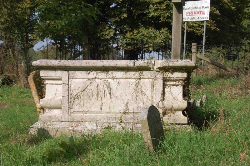
Entry Name: Tomb Approximately 11 Metres North East of Chancel of the Church of All Saints
Listing Date: 14 February 1986
Grade: II
Source: Historic England
Source ID: 1319132
English Heritage Legacy ID: 41591
ID on this website: 101319132
Location: All Saints' Church, Wokingham, Berkshire, RG7
County: Wokingham
Civil Parish: Swallowfield
Traditional County: Berkshire
Lieutenancy Area (Ceremonial County): Berkshire
Church of England Parish: Swallowfield
Church of England Diocese: Oxford
Tagged with: Tomb
SWALLOWFIELD CHURCH ROAD SU 76 SW (North-east side) 11/24 Tomb approximately 11 metres north-east of chancel of the Church of All Saints G.V. II Chest tomb. Late C18. Stone, moulded plinth and top. Recessed moulded corners, moulded side and end panels. The inscription is on the top slab but is badly eroded.
Listing NGR: SU7319364816
External links are from the relevant listing authority and, where applicable, Wikidata. Wikidata IDs may be related buildings as well as this specific building. If you want to add or update a link, you will need to do so by editing the Wikidata entry.


Other nearby listed buildings