Latitude: 51.4038 / 51°24'13"N
Longitude: -1.2615 / 1°15'41"W
OS Eastings: 451463
OS Northings: 167458
OS Grid: SU514674
Mapcode National: GBR 81V.ZVP
Mapcode Global: VHCZD.2ZX6
Plus Code: 9C3WCP3Q+G9
Entry Name: The Poplars
Listing Date: 10 November 1983
Grade: II
Source: Historic England
Source ID: 1319516
English Heritage Legacy ID: 39602
ID on this website: 101319516
Location: Thatcham, West Berkshire, RG18
County: West Berkshire
Civil Parish: Thatcham
Built-Up Area: Thatcham
Traditional County: Berkshire
Lieutenancy Area (Ceremonial County): Berkshire
Church of England Parish: Thatcham
Church of England Diocese: Oxford
Tagged with: Architectural structure
THATCHAM BATH ROAD (north side) SU 5167 8/2 3 And 3A (The Poplars)
GV II
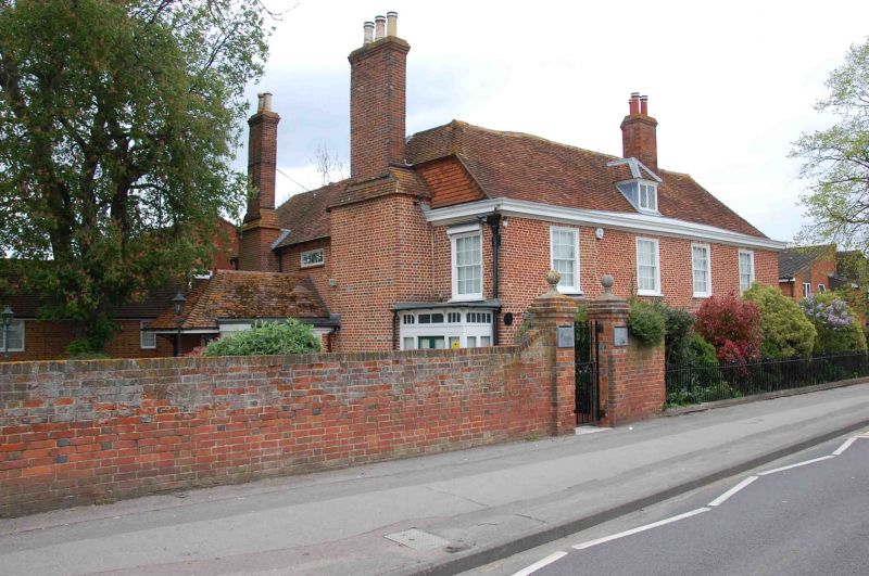
House. Late C18. Red brick with plat band, moulded wooden eaves cornice and hipped old tile roof, half hipped to left. End stack to left, stack on ridge off centre to right; central hipped dormer, and hipped dormer above right hand end wall, both with leaded casements. L-plan altered in C19 to form square. 2 storeys; 4 bays, glazing bar sashes with exposed wooden boxes. Early C20 ground floor rectangular bay windows with hipped tile roofs in each end bay. Blocked doorway in third bay from left, entrances now at right hand and to rear. Early C19 lead rainwater pipes and heads on both end walls. Interior: Various chamfered beams possibly from earlier house; Cl8 panelling in many rooms.
Listing NGR: SU5146567462
External links are from the relevant listing authority and, where applicable, Wikidata. Wikidata IDs may be related buildings as well as this specific building. If you want to add or update a link, you will need to do so by editing the Wikidata entry.


Other nearby listed buildings