Approximate Location Map
Large Map »
Latitude: 51.0534 / 51°3'12"N
Longitude: 0.63 / 0°37'48"E
OS Eastings: 584422
OS Northings: 131520
OS Grid: TQ844315
Mapcode National: GBR QW6.XRV
Mapcode Global: FRA D66B.H8D
Plus Code: 9F323J3J+92
Entry Name: 59 and 61, High Street
Listing Date: 16 August 1962
Grade: II
Source: Historic England
Source ID: 1320369
English Heritage Legacy ID: 180357
ID on this website: 101320369
Location: Rolvenden, Ashford, Kent, TN17
County: Kent
District: Ashford
Civil Parish: Rolvenden
Built-Up Area: Rolvenden
Traditional County: Kent
Lieutenancy Area (Ceremonial County): Kent
Tagged with: Building
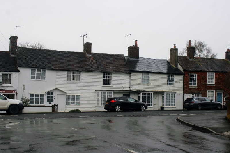
ROLVENDEN HIGH STREET
1.
5272 (east side)
Nos 59 and 61
TQ 8431 18/313 16.8.62.
II GV
2.
C18. Two storeys. No 61 is stuccoed. No 59 is weatherboarded. Tiled roof.
Two casements and one sash. Two doorcases to No 61 with shared pedimented
weatherhood. No 59 has a canted bay on ground floor and a flat hood.
Listing NGR: TQ8442231522
External links are from the relevant listing authority and, where applicable, Wikidata. Wikidata IDs may be related buildings as well as this specific building. If you want to add or update a link, you will need to do so by editing the Wikidata entry.


Other nearby listed buildings
