Latitude: 51.0536 / 51°3'12"N
Longitude: 0.6295 / 0°37'46"E
OS Eastings: 584384
OS Northings: 131538
OS Grid: TQ843315
Mapcode National: GBR QW6.XMX
Mapcode Global: FRA D66B.H1R
Plus Code: 9F323J3H+CQ
Entry Name: Disused Forge Adjoining No 64 to the South
Listing Date: 16 August 1962
Grade: II
Source: Historic England
Source ID: 1115641
English Heritage Legacy ID: 180345
ID on this website: 101115641
Location: Rolvenden, Ashford, Kent, TN17
County: Kent
District: Ashford
Civil Parish: Rolvenden
Built-Up Area: Rolvenden
Traditional County: Kent
Lieutenancy Area (Ceremonial County): Kent
Tagged with: Smithy Hall house House
ROLVENDEN HIGH STREET 1. 5272 (west side) Disused Forge adjoining No 64 to the south TQ 8431 18/301 16.8.62. II GV
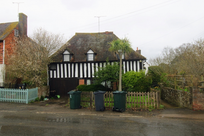
2. Probably originally late Mediaeval 2 storey hall-house. Two storeys close-studded. Hipped tiled roof. One original mullioned window. Modern garage entrances to ground floor.
Listing NGR: TQ8438231539
External links are from the relevant listing authority and, where applicable, Wikidata. Wikidata IDs may be related buildings as well as this specific building. If you want to add or update a link, you will need to do so by editing the Wikidata entry.


Other nearby listed buildings