Approximate Location Map
Large Map »
Latitude: 51.579 / 51°34'44"N
Longitude: -2.5781 / 2°34'41"W
OS Eastings: 360038
OS Northings: 186839
OS Grid: ST600868
Mapcode National: GBR JR.CN7H
Mapcode Global: VH882.8KFX
Plus Code: 9C3VHCHC+HQ
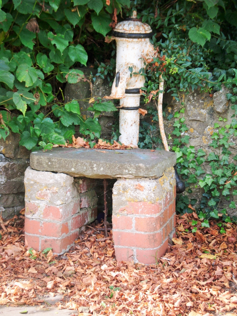
Entry Name: Pump and Stand
Listing Date: 5 December 1984
Grade: II
Source: Historic England
Source ID: 1321048
English Heritage Legacy ID: 35298
ID on this website: 101321048
Location: Olveston, South Gloucestershire, BS35
County: South Gloucestershire
Civil Parish: Olveston
Built-Up Area: Olveston
Traditional County: Gloucestershire
Lieutenancy Area (Ceremonial County): Gloucestershire
Church of England Parish: Olveston
Church of England Diocese: Bristol
Tagged with: Pump
ST 68 NW
8/189
OLVESTON
THE GREEN (west side) Olveston
Pump and stand
II
Pump and stand for buckets. C19. Cast iron, stand of brick with sandstone
flat top. Pump has decorative spout and fluted finial, handle, painted black
and white. Former well was in orchard to west, after enclosure of The Green,
pump at roadside was erected by Mr. Edwin Organ, c.1870.
Listing NGR: ST6003886839
External links are from the relevant listing authority and, where applicable, Wikidata. Wikidata IDs may be related buildings as well as this specific building. If you want to add or update a link, you will need to do so by editing the Wikidata entry.


Other nearby listed buildings
