Latitude: 51.5971 / 51°35'49"N
Longitude: -2.578 / 2°34'40"W
OS Eastings: 360057
OS Northings: 188852
OS Grid: ST600888
Mapcode National: GBR JR.BN6P
Mapcode Global: VH882.84G0
Plus Code: 9C3VHCWC+RQ
Entry Name: Stable About 7 Metres South West of Court Farmhouse
Listing Date: 5 December 1984
Grade: II
Source: Historic England
Source ID: 1321071
English Heritage Legacy ID: 35204
ID on this website: 101321071
Location: Elberton, South Gloucestershire, BS35
County: South Gloucestershire
Civil Parish: Aust
Traditional County: Gloucestershire
Lieutenancy Area (Ceremonial County): Gloucestershire
Church of England Parish: Elberton
Church of England Diocese: Bristol
Tagged with: Stable
ST 68 NW AUST ELBERTON
8/102 Stable about 7 metres south west of Court Farmhouse G.V. II
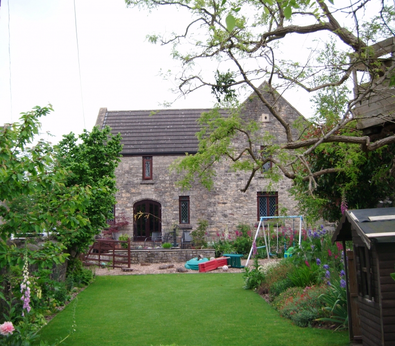
Stable. Mid C19. Coursed rubble with stone and brick dressings, concrete tiled roof with raised coped verges and kneelers to front and stone ridge. T-plan. 2 storeys, all wings with gable fronts, 1:1 windows, all single or 2-light round-headed windows with leaded diamond lights, flat head and weathered cill, door with chamfered segmental head central to left block and on west side of front wing, small bull's-eye in gable; west side has loading door at upper level, east side has 2-light casement in segmental head at ground floor. Rear has cart entry with gauged brick segmental head, loading door above, bull's eye to each side and weathervane on gable front, single storey extension to right. Interior: roof not accessible.
Listing NGR: ST6005788852
External links are from the relevant listing authority and, where applicable, Wikidata. Wikidata IDs may be related buildings as well as this specific building. If you want to add or update a link, you will need to do so by editing the Wikidata entry.


Other nearby listed buildings