Approximate Location Map
Large Map »
Latitude: 51.6061 / 51°36'21"N
Longitude: -2.5262 / 2°31'34"W
OS Eastings: 363652
OS Northings: 189822
OS Grid: ST636898
Mapcode National: GBR JT.B37V
Mapcode Global: VH87X.5WBP
Plus Code: 9C3VJF4F+CG
Entry Name: 71, High Street
Listing Date: 17 December 1984
Grade: II
Source: Historic England
Source ID: 1321139
English Heritage Legacy ID: 34948
ID on this website: 101321139
Location: Thornbury, South Gloucestershire, BS35
County: South Gloucestershire
Civil Parish: Thornbury
Built-Up Area: Thornbury
Traditional County: Gloucestershire
Lieutenancy Area (Ceremonial County): Gloucestershire
Church of England Parish: Thornbury St Mary
Church of England Diocese: Gloucester
Tagged with: Building
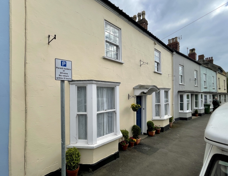
THORNBURY HIGH STREET
5/45
(east side)
ST 6389
No 71
GV
II
Mid-late C18, probable remodelling of late C17 building. Render, lined as
ashlar. Pantiled roof. Two storeys. Two windows, glazing bar sashes. Later
bays on ground floor. Central 6-panel door under segmental hood on
brackets.
Listing NGR: ST6365289822
External links are from the relevant listing authority and, where applicable, Wikidata. Wikidata IDs may be related buildings as well as this specific building. If you want to add or update a link, you will need to do so by editing the Wikidata entry.


Other nearby listed buildings
