Approximate Location Map
Large Map »
Latitude: 51.4569 / 51°27'24"N
Longitude: -0.974 / 0°58'26"W
OS Eastings: 471380
OS Northings: 173605
OS Grid: SU713736
Mapcode National: GBR QLF.95
Mapcode Global: VHDWT.2MFZ
Plus Code: 9C3XF24G+Q9
Entry Name: 39, Friar Street
Listing Date: 14 December 1978
Grade: II
Source: Historic England
Source ID: 1321951
English Heritage Legacy ID: 38953
ID on this website: 101321951
Location: Reading, RG1
County: Reading
Electoral Ward/Division: Abbey
Built-Up Area: Reading
Traditional County: Berkshire
Lieutenancy Area (Ceremonial County): Berkshire
Church of England Parish: Reading St Mary the Virgin
Church of England Diocese: Oxford
Tagged with: House Building Retail building
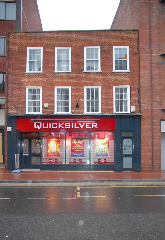
FRIAR STREET
1.
5128
(North Side)
No 39
SU 7173 12/119
II
2.
C18. 3 storeys. Brick with parapet. Plain 4 window front, flush framed glazing
bar sashes. Modern shopfront to ground floor.
Listing NGR: SU7138073605
This text is from the original listing, and may not necessarily reflect the current setting of the building.
External links are from the relevant listing authority and, where applicable, Wikidata. Wikidata IDs may be related buildings as well as this specific building. If you want to add or update a link, you will need to do so by editing the Wikidata entry.


Other nearby listed buildings
