Approximate Location Map
Large Map »
Latitude: 51.9889 / 51°59'20"N
Longitude: 0.1568 / 0°9'24"E
OS Eastings: 548196
OS Northings: 234468
OS Grid: TL481344
Mapcode National: GBR LB1.BGP
Mapcode Global: VHHL8.N8SN
Plus Code: 9F32X5Q4+HP
Entry Name: Pump on Village Green
Listing Date: 22 February 1980
Grade: II
Source: Historic England
Source ID: 1322450
English Heritage Legacy ID: 121409
ID on this website: 101322450
Location: Arkesden, Uttlesford, Essex, CB11
County: Essex
District: Uttlesford
Civil Parish: Arkesden
Built-Up Area: Arkesden
Traditional County: Essex
Lieutenancy Area (Ceremonial County): Essex
Church of England Parish: Arkesden St Mary the Virgin
Church of England Diocese: Chelmsford
Tagged with: Pump
ARKESDEN THE VILLAGE
1.
5222
(south side)
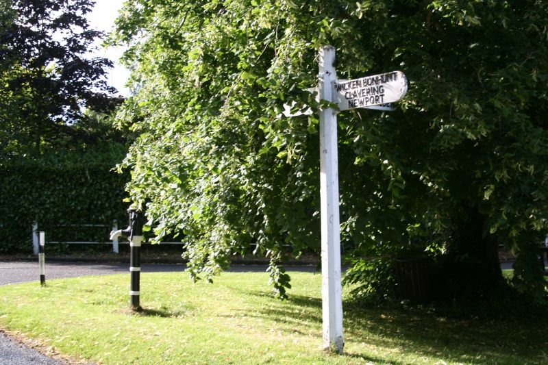
Pump on Village Green
TL 4834 36/967
II GV
2.
C19 cast iron pump with spout and handle (broken).
Listing NGR: TL4819634468
External links are from the relevant listing authority and, where applicable, Wikidata. Wikidata IDs may be related buildings as well as this specific building. If you want to add or update a link, you will need to do so by editing the Wikidata entry.


Other nearby listed buildings
