Approximate Location Map
Large Map »
Latitude: 51.9883 / 51°59'17"N
Longitude: 0.1575 / 0°9'26"E
OS Eastings: 548244
OS Northings: 234398
OS Grid: TL482343
Mapcode National: GBR LB1.BM9
Mapcode Global: VHHL8.P934
Plus Code: 9F32X5Q4+8X
Entry Name: Hill House
Listing Date: 22 February 1980
Grade: II
Source: Historic England
Source ID: 1112479
English Heritage Legacy ID: 121407
ID on this website: 101112479
Location: Arkesden, Uttlesford, Essex, CB11
County: Essex
District: Uttlesford
Civil Parish: Arkesden
Built-Up Area: Arkesden
Traditional County: Essex
Lieutenancy Area (Ceremonial County): Essex
Church of England Parish: Arkesden St Mary the Virgin
Church of England Diocese: Chelmsford
Tagged with: House
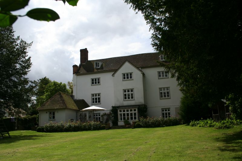
ARKESDEN THE VILLAGE
1.
5222
(south side)
Hill House
TL 4834 36/11
II GV
2.
C18 and later timber-framed and plastered house. Three storeys. Three window
range, casements. The centre part, of one window range, breaks forward on
the front with a gable and a porch on the ground storey. Roof tiled, with
end chimney stacks.
Listing NGR: TL4824434398
External links are from the relevant listing authority and, where applicable, Wikidata. Wikidata IDs may be related buildings as well as this specific building. If you want to add or update a link, you will need to do so by editing the Wikidata entry.


Other nearby listed buildings
