Latitude: 54.5262 / 54°31'34"N
Longitude: -1.8367 / 1°50'12"W
OS Eastings: 410666
OS Northings: 514563
OS Grid: NZ106145
Mapcode National: GBR HJM3.47
Mapcode Global: WHC5R.RHKG
Plus Code: 9C6WG5G7+F8
Entry Name: Whorlton Suspension Bridge, over the River Tees
Listing Date: 19 January 1952
Grade: II*
Source: Historic England
Source ID: 1322762
English Heritage Legacy ID: 111787
ID on this website: 101322762
Location: Whorlton, County Durham, DL12
County: County Durham
Civil Parish: Wycliffe with Thorpe
Traditional County: Yorkshire
Lieutenancy Area (Ceremonial County): County Durham
Church of England Parish: Barnard Castle with Whorlton
Church of England Diocese: Durham
NZ 11 SW WYCLIFFE WITH THORPE WHORLTON
7/200 Whorlton Suspension Bridge, over the 19.1.52 River Tees
II*
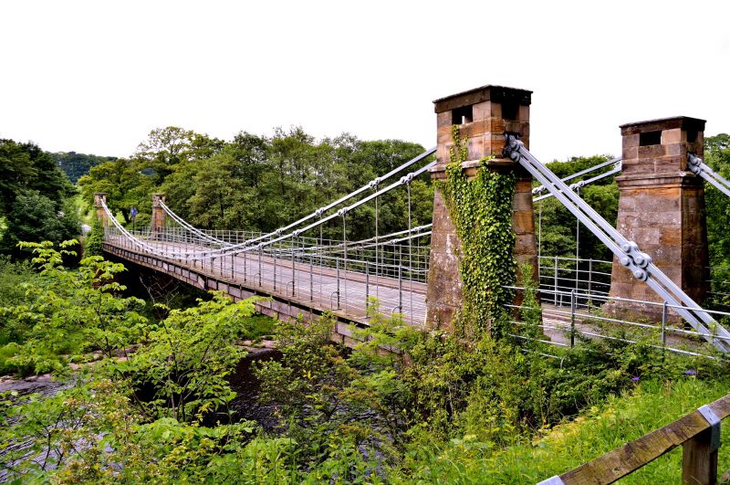
Suspension road bridge, 1829-31 by John and Benjamin Green. Rock-faced piers, tooled-and-margined stone pylons. Wood-planked roadway; wrought-iron suspension chains and links. Single span of almost 53 metres. Battered rectangular-plan piers rising from massive plinth to a double blocking course. Each pier carries 2 battered corniced pylons, flanking roadway, and supporting blocks through which the double suspension chains pass. Roadway, 10 metres above river, has plain railings, continued to octagonal end piers with corniced caps, except to north-west where railings join toll house.
Rare example of an unaltered early C19 suspension bridge.
Partly in Whorlton parish.
Listing NGR: NZ1066614563


Other nearby listed buildings