Latitude: 54.7827 / 54°46'57"N
Longitude: -1.5751 / 1°34'30"W
OS Eastings: 427423
OS Northings: 543169
OS Grid: NZ274431
Mapcode National: GBR KFF4.SB
Mapcode Global: WHC4Q.S14V
Plus Code: 9C6WQCMF+3W
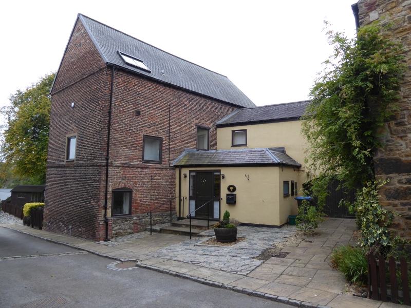
Entry Name: Barn West of Crook Hall
Listing Date: 10 March 1988
Grade: II
Source: Historic England
Source ID: 1323252
English Heritage Legacy ID: 110204
ID on this website: 101323252
Location: The Sands, County Durham, DH1
County: County Durham
Electoral Ward/Division: Elvet and Gilesgate
Parish: City of Durham
Built-Up Area: Durham
Traditional County: Durham
Lieutenancy Area (Ceremonial County): County Durham
Church of England Parish: Durham St Cuthbert
Church of England Diocese: Durham
Tagged with: Barn
DURHAM AND FRAMWELLGATE FRAMWELLGATE WATERSIDE NZ24SE (North end off)
4/152 Barn west of Crook Hall.
GV II
Barn and loft. Early C18. Sandstone rubble with ashlar quoins and brick dressings; Welsh slate roof, 2 storeys, 3 bays. Loading door at left under brick elliptical arch. Right return gable has pitching-hole with boarded doors.
Listing NGR: NZ2742343169
External links are from the relevant listing authority and, where applicable, Wikidata. Wikidata IDs may be related buildings as well as this specific building. If you want to add or update a link, you will need to do so by editing the Wikidata entry.


Other nearby listed buildings